
Work is nearing completion for the third and final stretch of Navy Pier Flyover, a 1,750-foot-long elevated bikeway/walkway that replaces a portion of the Lakefront trail near the namesake pier. Planned by the Department of Transportation, the project will reconcile the paths to the north and the south, previously encumbered by uneven terrain and water.
Navy Pier Flyover’s third-phase bridge section. Photo by Jack Crawford
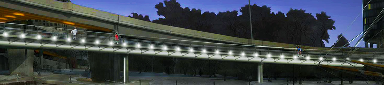
Navy Pier Flyover tube design. Rendering by HNTB
HNTB served as the designer of the project, which uses a spine-like steel tube with flanking “ribs” throughout the majority of the project, which allows it to curve around unlimited degrees of freedom.
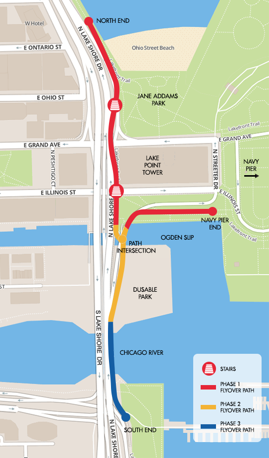
Navy Pier Flyover phases (third phase in blue). Map via City of Chicago
The overall development has been divided into three phases, two of which are already operational to the north of the river.
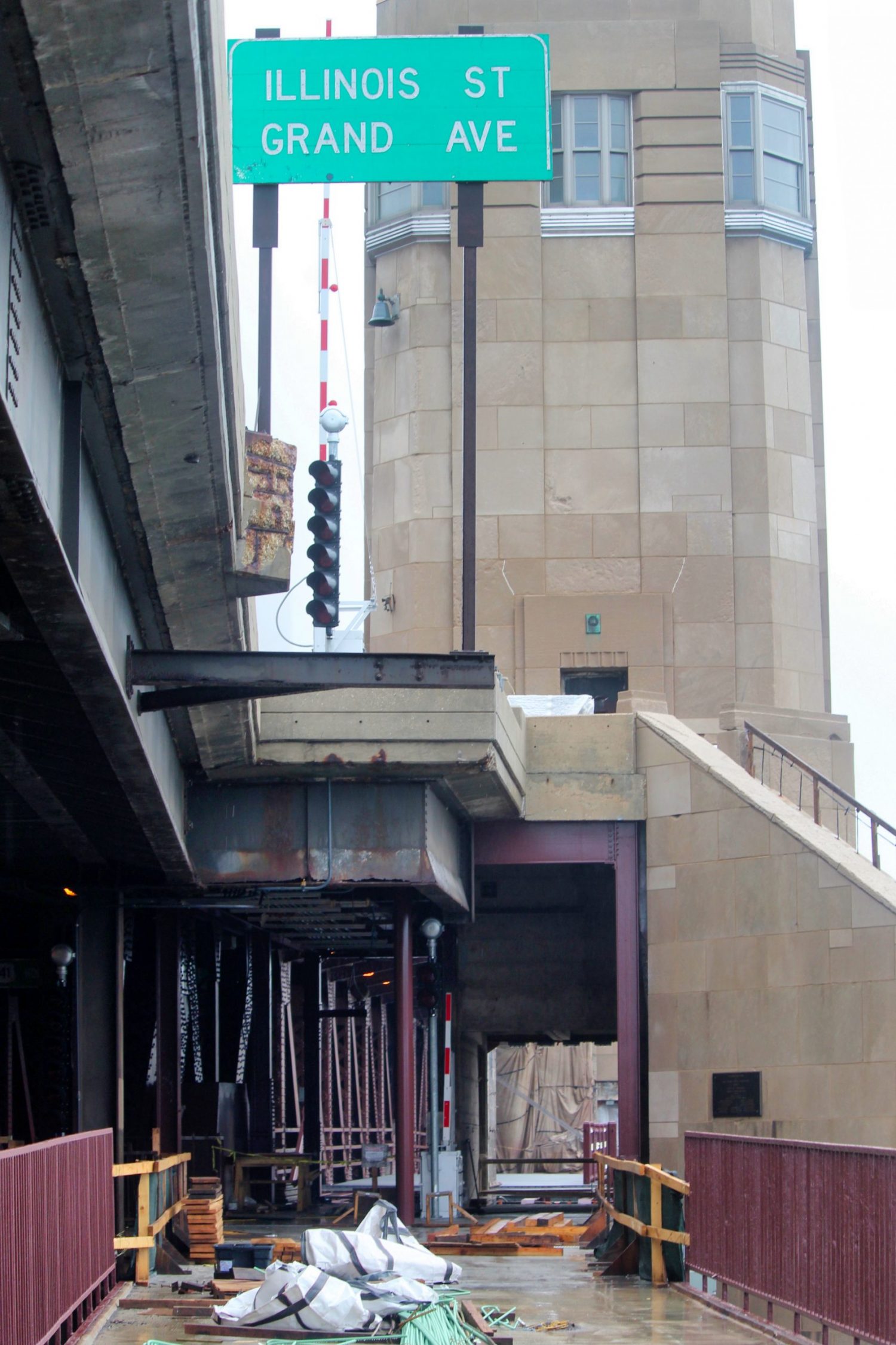
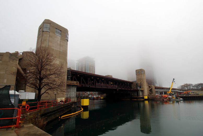
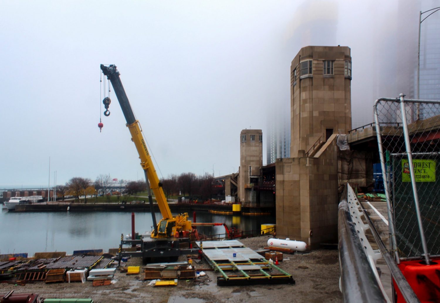
Navy Pier Flyover’ third-phase bridge section. Photo by Jack Crawford
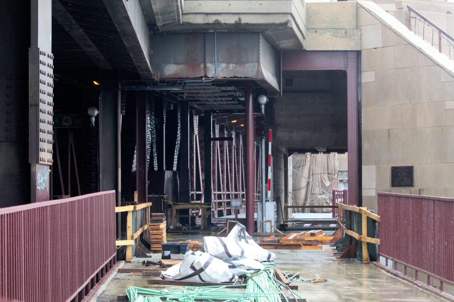
Navy Pier Flyover third-phase bridge section. Photo by Jack Crawford
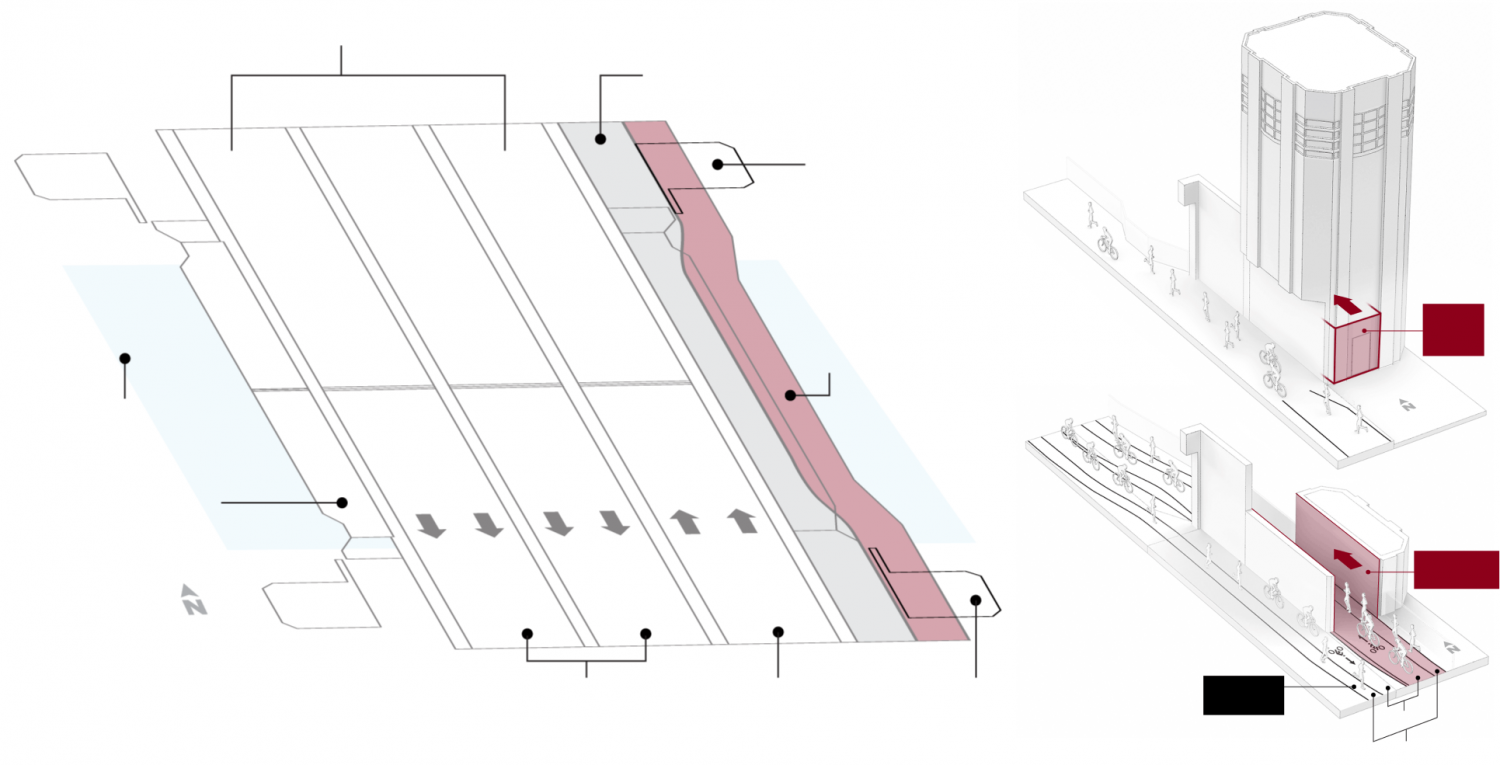
Diagrams of Navy Pier Flyover third-phase bridge portion (in red), via Chicago Tribune
The third, southernmost, and last section of the Flyover integrates with the existing Outer Drive Bridge. To accommodate a wider lane for the Flyover alongside the bridge, tunnel-like openings had to be carved out of the bridge’s two eastern towers. As the Flyover crosses the river, its spine-like shape will camouflage into a painted cantilevered platform that blends with the architecture of the original bridge.
Nearby CTA bus access on the Streeterville side of the river includes Routes 2, 29, 65, 66, 120, 121, and 124. To the south in the New Eastside area is immediate access for Route 60. Further west and northwest are additional stops for Routes 4, 6, 20, 124, 134, 135, and 136.
Nearest CTA L access for the Flyover’s northern end includes a 19-minute walk west to the Red Line’s Grand station. The southern end has wider access to all the lines via various stops, available via a 20-minute walk southwest to The Loop.
A plethora of attractions can be found in the vicinity, including Ohio Street Beach at the northern end, Navy Pier to the east, the 319-acre Grant Park to the south, The Loop to the southwest, and the river with its bordering Riverwalk to the west.
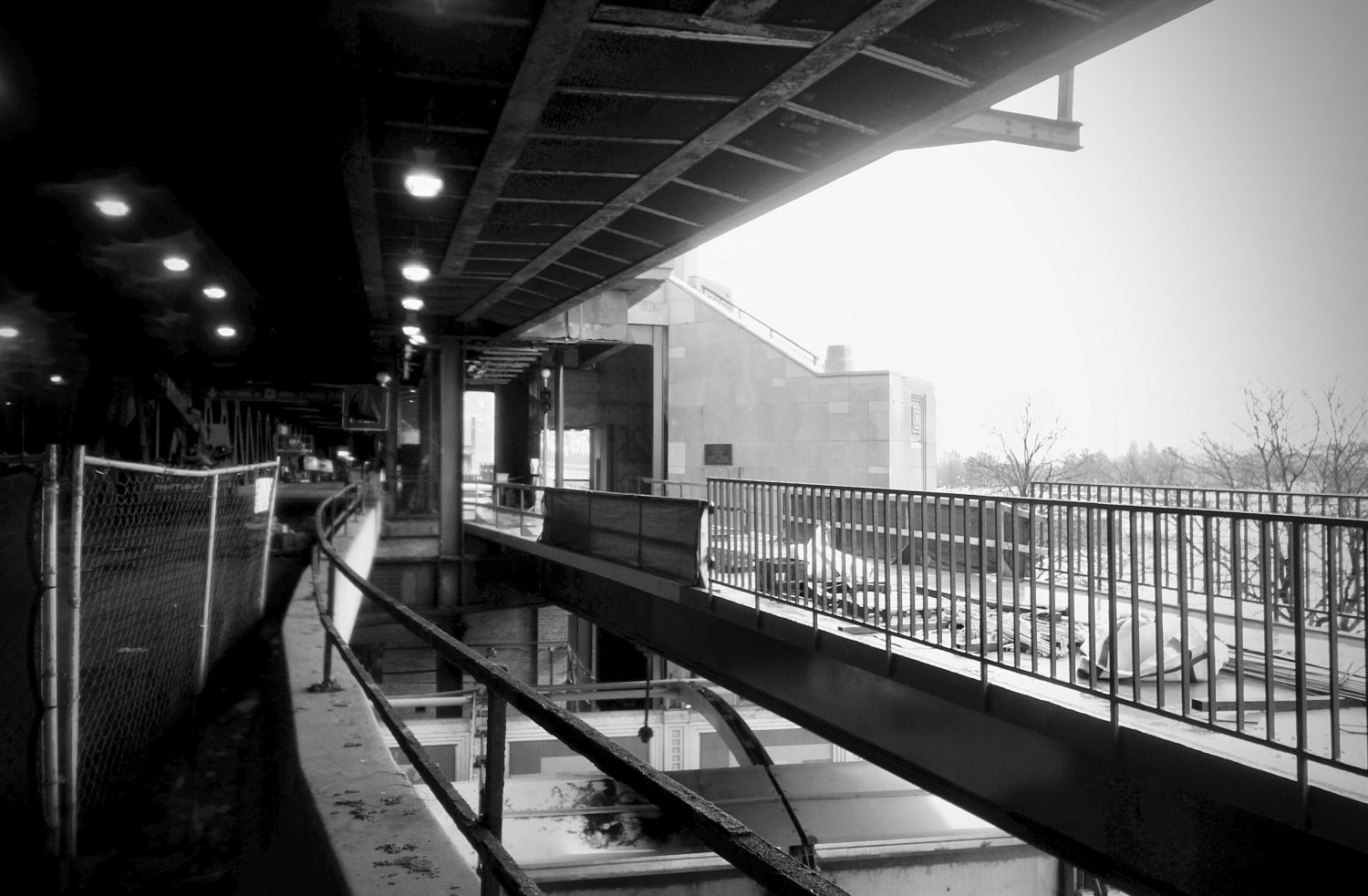
Navy Pier Flyover. Photo by Jack Crawford
Despite a series of delays and increased construction costs, a full opening is slated for the end of this year.
Subscribe to YIMBY’s daily e-mail
![]()
Follow YIMBYgram for real-time photo updates
Like YIMBY on Facebook
Follow YIMBY’s Twitter for the latest in YIMBYnews
Be the first to comment on "Navy Pier Flyover Nearing Finish Line Along the Chicago River"