
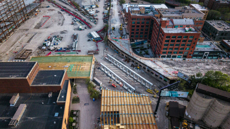
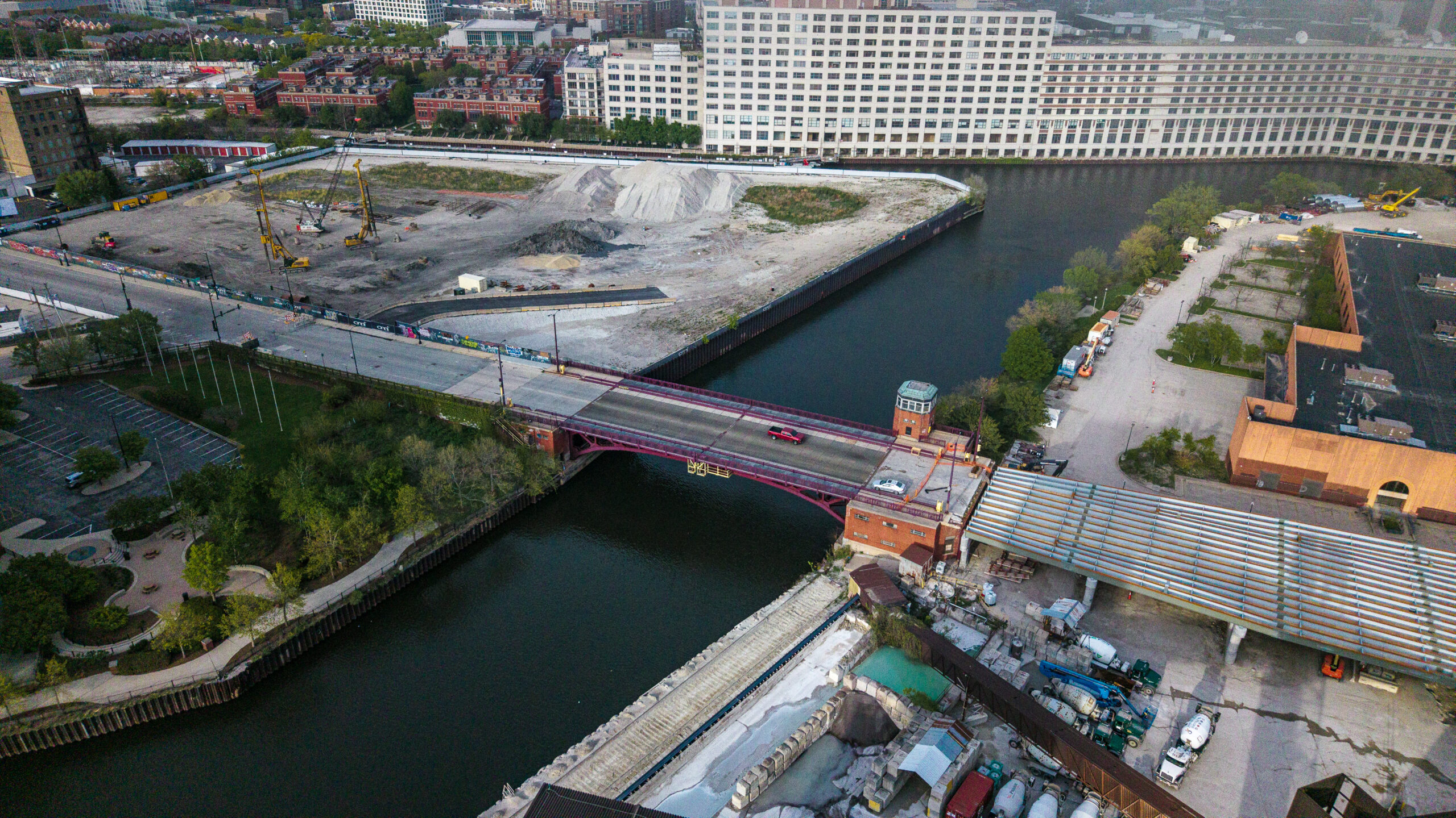
A YIMBY reader sent over some drone shots from a late-April flyover of the Halsted Street Viaduct reconstruction. There are also glimpses of casino work, and the very beginnings of caisson activity at Halsted Pointe. Huge thank you to Patrick for dropping these images on us. Not many folks get this perspective of the city.
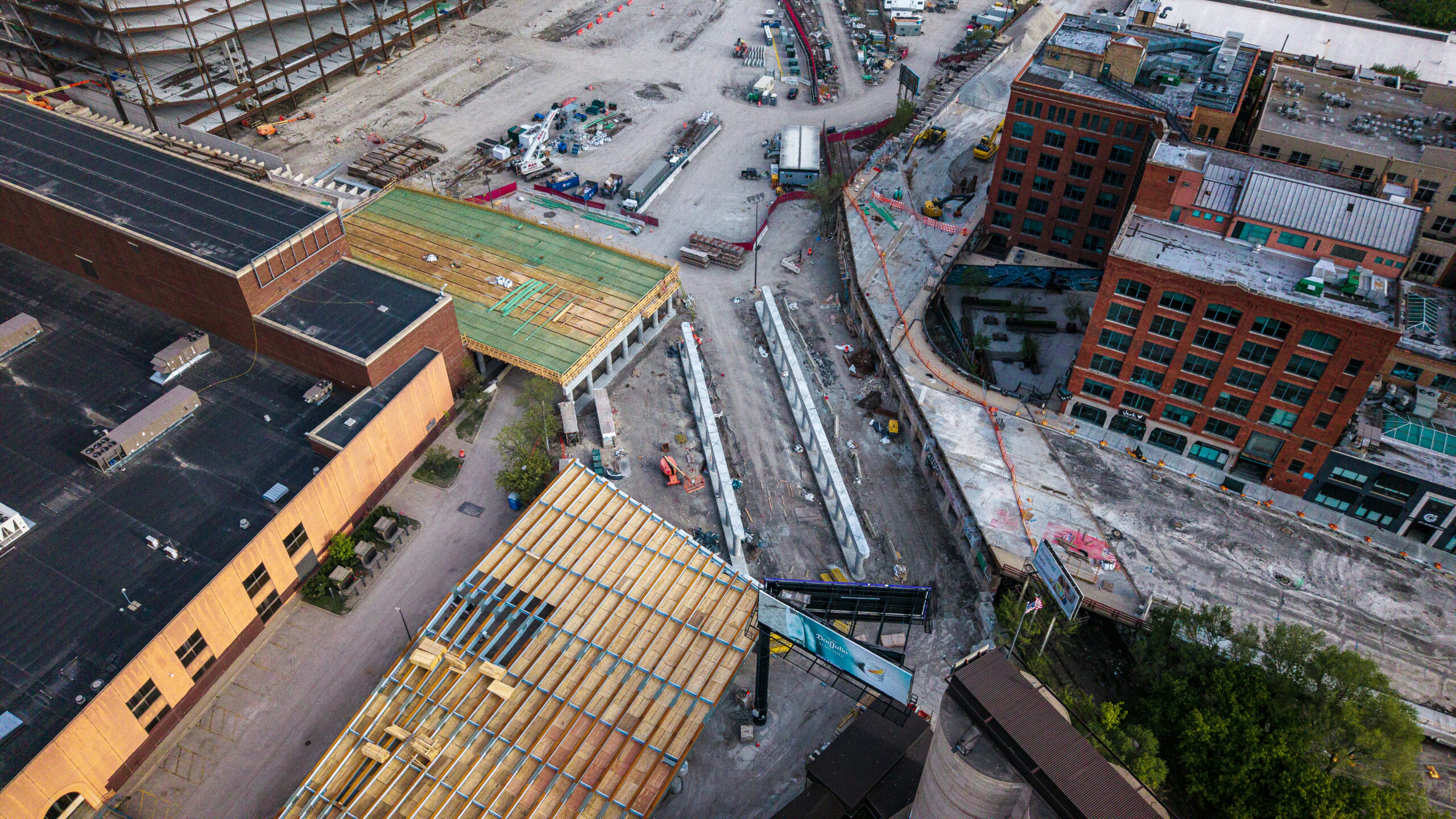
Image provided by Patrick Williams
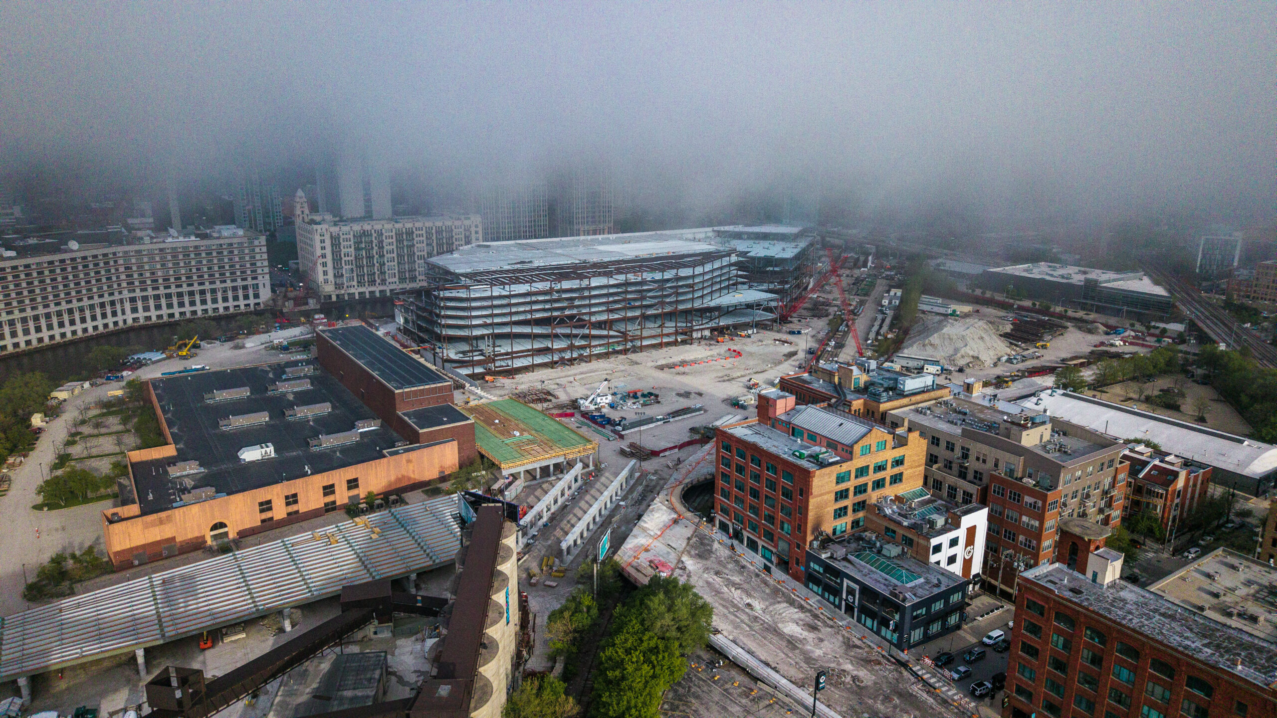
Casino construction in the background; fog obscures the hotel tower. Image provided by Patrick Williams
Caisson rigs on site for Halsted Pointe. Image provided by Patrick Williams
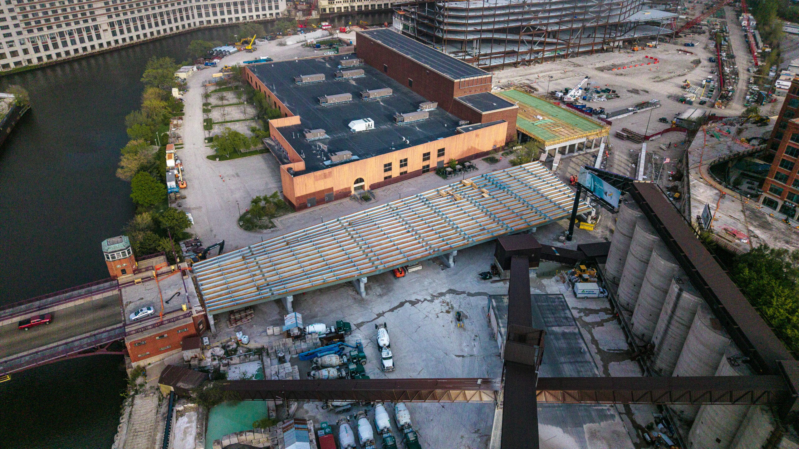
Image provided by Patrick Williams
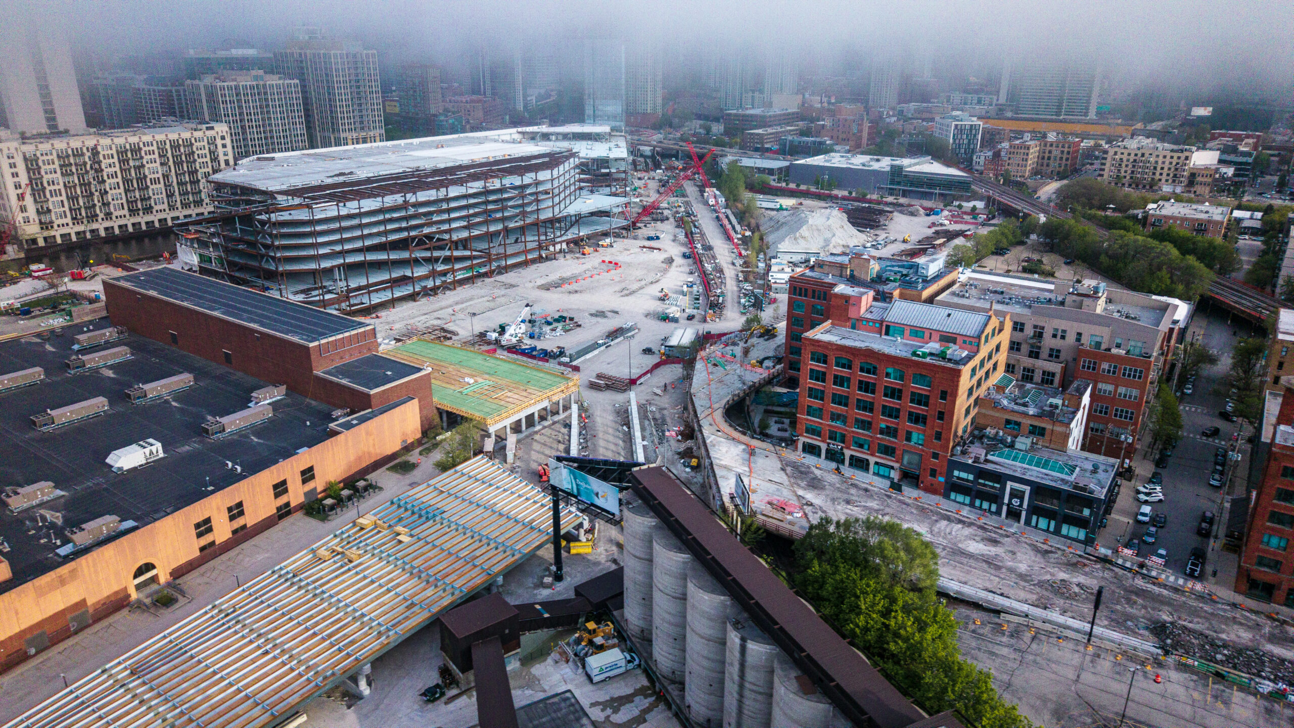
Image provided by Patrick Williams
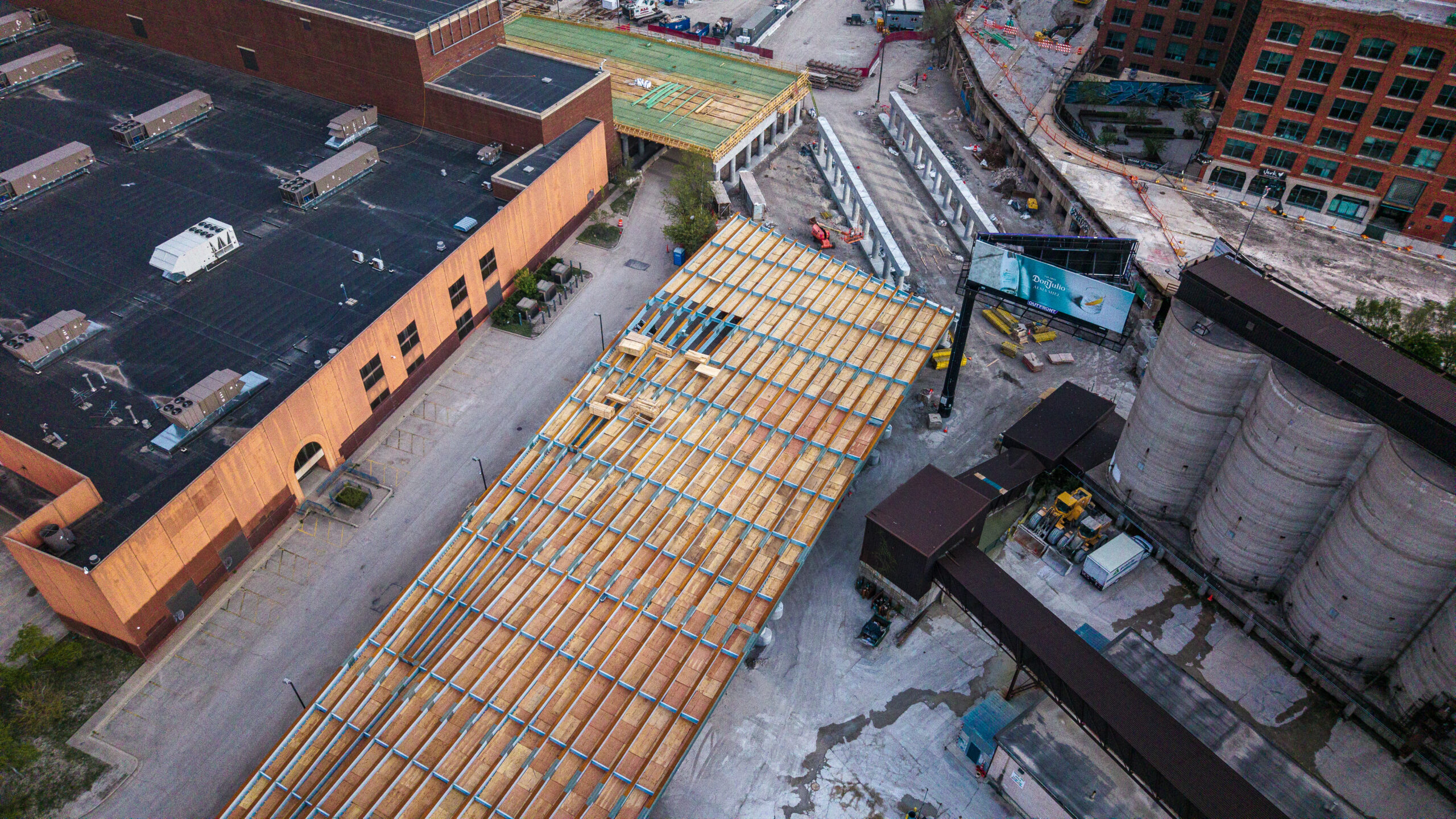
Image provided by Patrick Williams
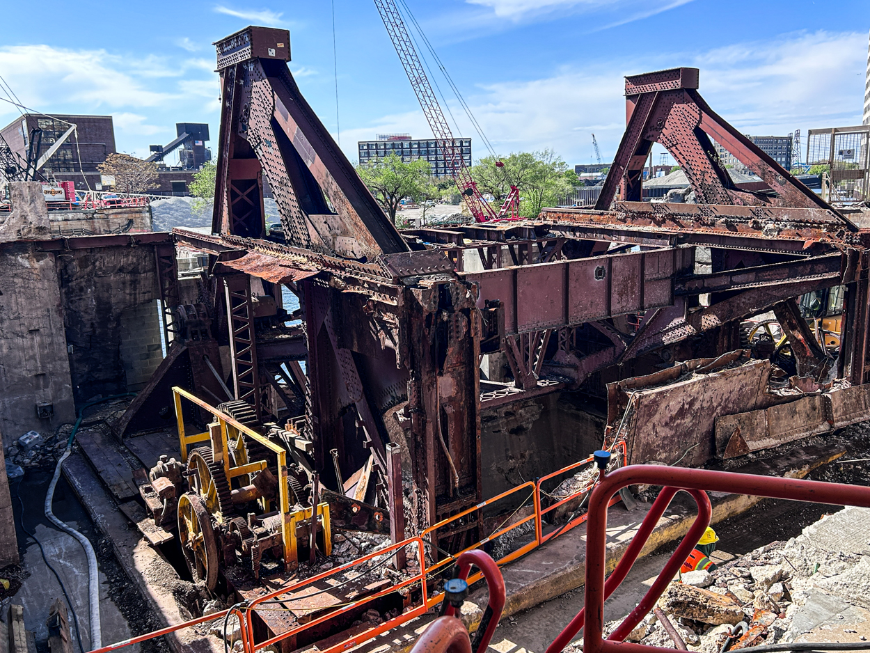
Over on the east bank at Chicago Avenue, the bridge house is gone, but the old bridge machinery — the mechanical guts that raised and lowered the span — remains in place. On a previous visit, we noticed protective plywood in use to keep the mechanics safe during demolition. It appears it’s being preserved.
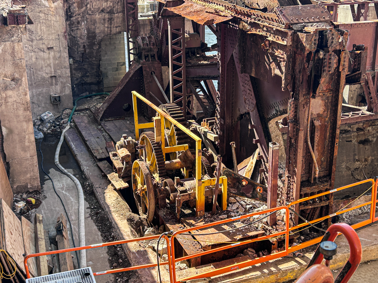
Photo by Daniel Schell
Crews continue demolition on the east end of the Chicago Avenue Bridge over the river. Photo by Daniel Schell
Subscribe to YIMBY’s daily e-mail
![]()
Follow YIMBYgram for real-time photo updates
Like YIMBY on Facebook
Follow YIMBY’s Twitter for the latest in YIMBYnews
I’m still wondering why this is even still a viaduct. I was always under the impression that rail spur use had basically been discontinued, as the only thing it served was Blommers and that is also defunct.
I thought the same thing, but relocating everything would almost certainly be more challenging. The bridges are already a dozen+ feet above the “ground level” and it might just be easier to rebuild the viaduct than changing bridge approaches and elevations. Also, I’m imagine there are regulations that would not allow for the City to put a new grade crossing on the UP tracks, even if they are no longer being used for rail freight (they were in use up until after the project broke ground, I believe). It certainly could have been done I’m sure, but this was ultimately probably decided upon because the status quo was easier to maintain.
Where do the tracks lead? Was this the proposed route of some transit alternative pitched for Lincoln Yards a long while back?
Yes, but Sterling Bay was not very serious about their Lincoln Yards proposal, seeing as they were in so far over their heads that they had to sell all the land. The tracks lead to the (former, RIP) Blommer Chocolate Factory on Kinzie. There is another spur that continues to the old rail bridge south of Kinzie that is stuck elevated 364 days a year, except for the 1 day it is lowered so the railroad can consider it actively used.
The rail spur could easily be used for a transit right-of-way in the future!
Maintaining this transit right of way through the site is a key component of the master plan that was approved by the city. My hope is that it can be part of the right of way of a future north/south subway for the Red Line running from roughly North/Clybourn to the 16th Street Portal just north of Chinatown.
Since that, along with a new portal connecting the Brown Line to the State Street Subway, would allow for the Brown Line to merge with the south side elevated branches. Meaning increased service not just on those routes, but on all of the branches that use the loop elevated structure.
What is CDOT doing with this project? Is there a project page?