
Getting around in the River West neighborhood is a chore these days. That’s all thanks to the ambitious project underway to rebuild the Halsted Street viaduct and replace the Chicago Avenue Bridge over the river.
Both streets are now closed to vehicular as well as pedestrian traffic, so even taking a peek at what’s happening is a difficult task. Here’s a look at what can be seen from nearby as work continues on the project, which promises to keep both streets thoroughfares closed until late in 2026. All photos were taken November 23, 2025 during an outing to catch up on casino progress.
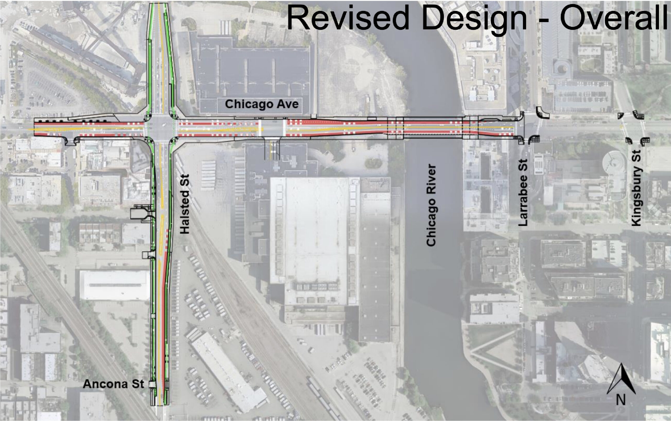
Site map of reconstructed intersection via CDOT
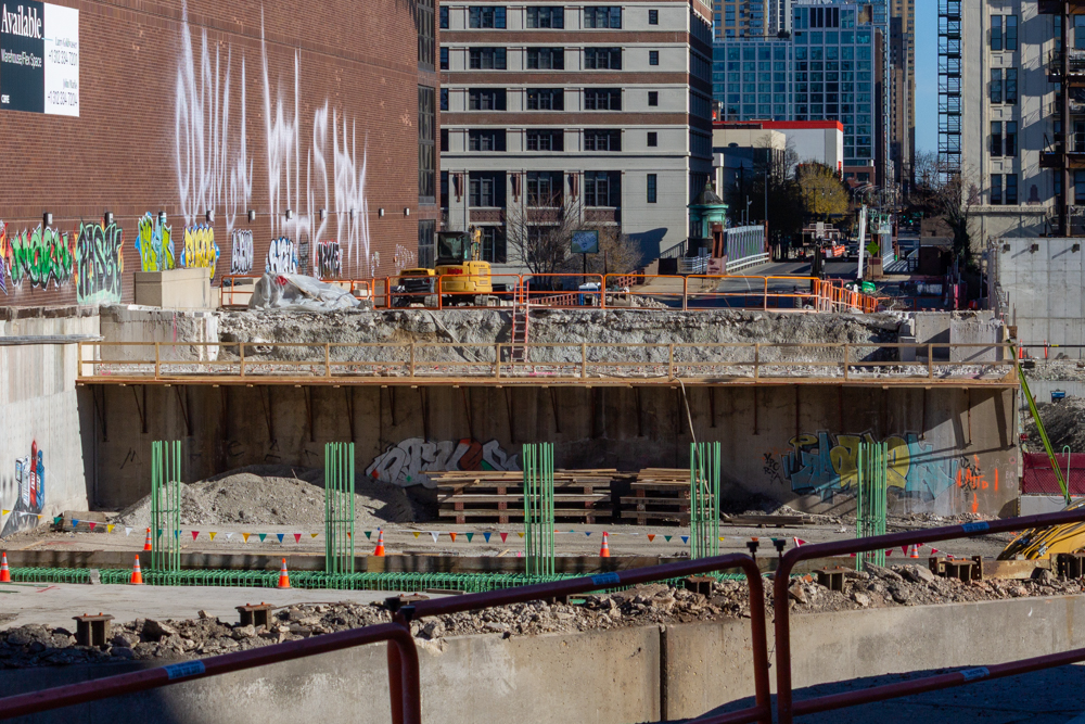
Photo by Daniel Schell
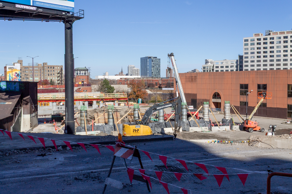
Photo by Daniel Schell
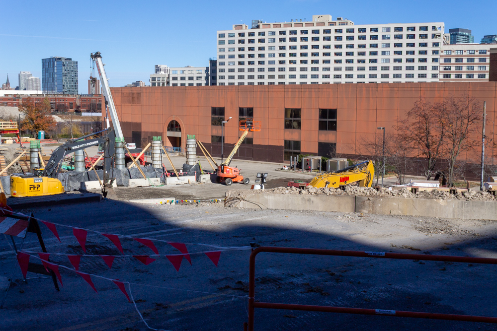
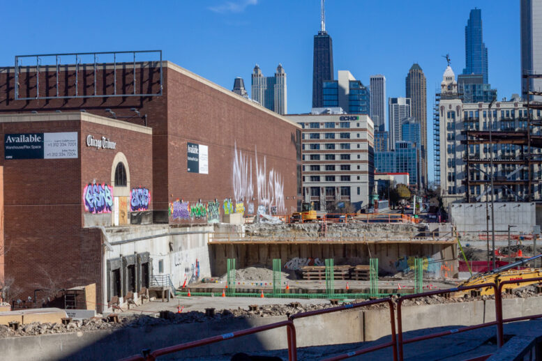
Halsted Street in front of Freedom Center North. Photo by Daniel Schell

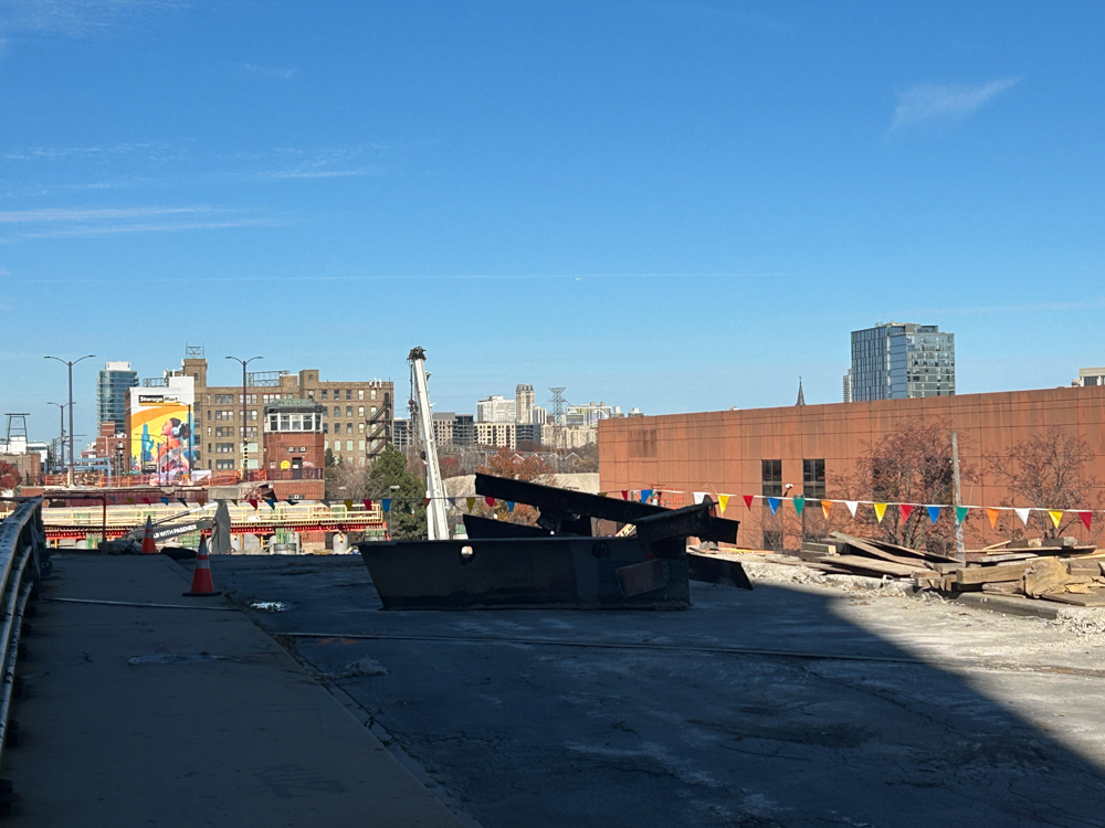
Halsted Street north of Chicago Avenue. Photo by Daniel Schell
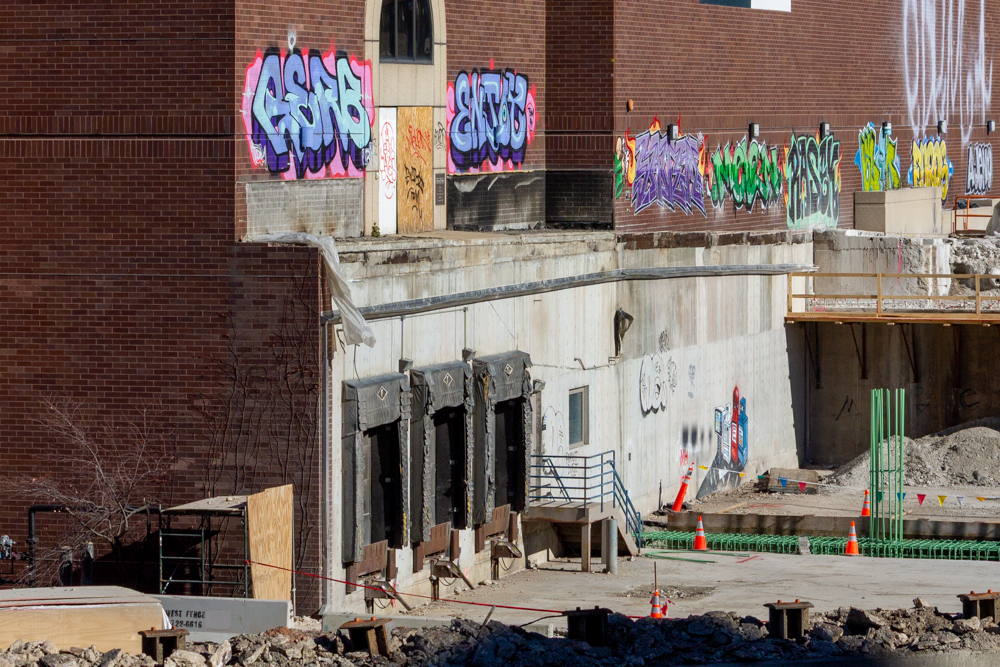
Loading docks at the Freedom Center North, previously hidden beneath street level. Photo by Daniel Schell
Looking north up Halsted Street. Photo by Daniel Schell
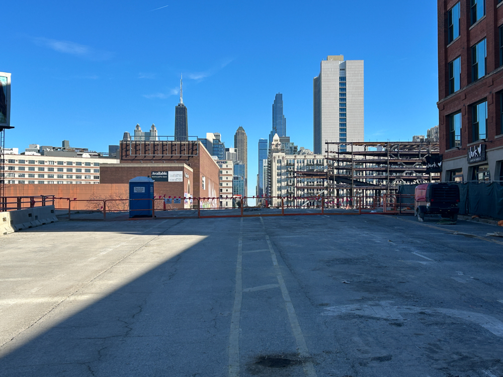
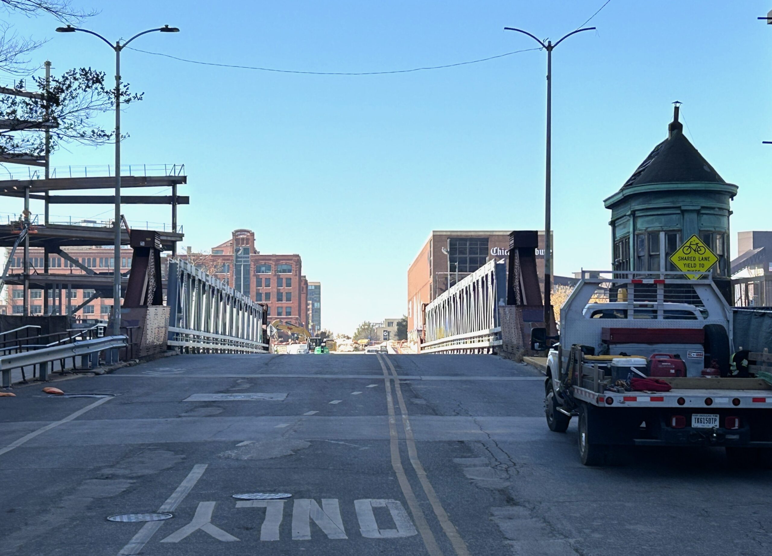
Chicago Avenue, just west of Halsted Street. Photo by Daniel Schell
Chicago Avenue Bridge demolition is expected in January. Photo by Daniel Schell
Subscribe to YIMBY’s daily e-mail
![]()
Follow YIMBYgram for real-time photo updates
Like YIMBY on Facebook
Follow YIMBY’s Twitter for the latest in YIMBYnews
Why on earth aren’t they replacing the bridge at the same time?
Because it is CDOT. They shut it down on 29 Sep and will get to it in Jan. They have already posted that the bridge will not be back until Jan 2027. I would bet more like Q2 2027.
Likely because of construction access needs. I wonder if it is for the Casino, or some aspect of the viaduct construction that requires eastern access.
How do you propose they tie the bridge into the non-existent road? Or perform the additional demo work now that there is no access from the west? The bridge is probably majority pre-fabbed and will be moved on site at a later date.
Don’t you know how bridge gravity works? Obviously, you place the truss/arch in the air, then build the legs, and wrap up some foundation work underneath it all.
There’s a flow to it. I personally think the top-down approach is best.
Daniel, you just need to learn how to levitate to get those shots. Ever think about a small drone to get an extra 10-20 feet of height?
Christmas is coming up, Steve…
Great photos! They give a good sense of the complexity of the work at this intersection.
I wonder what utility work is being added to this all. Were the water and sewage lines already sized for the coming thousands of new residences? The sites have been industrial for the past century.
Danial
I always enjoy your photos. Helps me give my tours and as I’m in the neighborhood, keeps me abreast of Bally’s impact like detours that obstruct my entry / exit from my complex.
Pertaining to drone shots … has ICE now allowed drone activity in Chicago?
Nice to hear, thank you.
Outside of the FAA ban for a couple weeks in October, I don’t know of any other limitations. But as a non-droner, I don’t stay up to date.
When ICE decides drone activity is no longer allowed in the city we’ll learn of that by drones starting to explode in mid-air. Days or weeks later at 219 S. Dearborn somebody from the administration will dissemble under oath, an exasperated federal judge will start issuing procedural orders, rinse and repeat.
Most neighbors don’t know the actual streets were demolished. Just yesterday, a guy in the larrabee dog park was complaining – traffic, street closures, no work done, WTF man. I suggested, just Bluesmobile past the gates, no traffic to Milwaukee!
OK, I’ll admit to being dumb. Some of the Freedom Center is still standing? Why did I think the entire building was demolished for the new casino?
That’s the building North of Chicago Ave, which will be demolished eventually for a different development.
What Jacob said….
This is the “Freedom Center North” which is planned for demolition to make room for Halsted Landing.
Is this blurb about Freedom Center North accurate?
Universal Horror Unleashed: Chicago
In June 2025, Universal announced the city of Chicago would be the second Universal Horror Unleashed location and the first Universal attraction in the Midwest, The attraction will be located in the former Freedom Center North building, construction is slated to begin in early 2026 after design plans are finalized and permits secured. The attraction is tentatively scheduled to open in 2027.
I haven’t heard anything contrary to that.
It’s a shame if a lot of materials are put into the structure only to be taken down later, but it sounds like it’s going to be a minute before that plot of land sees any big changes. The road work alone is significant for future use. With an early start for Universal, the viduct is a direct road block to the site, though. That road is the only access for construction.
I predict the change of plans for the property will be reliant on the success of the casino. Develop it all at once? It would be perfect timing, but at least there will be a support entertainment option in the works.
Looks like the temp bridge was finally removed in the first week of Feb 2026. YAY!