
Road closures are in place in River West to begin reconstruction of the Halsted Street viaduct at Chicago Avenue and the replacement of the Chicago Avenue Bridge over the river. The city estimates closures will be in place until summer 2026 on Halsted, and through December 2026 on Chicago Avenue.
During planned work, Chicago Avenue is reduced to one lane in each direction until October, when it will be completely closed, and Halsted Street is closed from North Branch Street south to Erie Street.
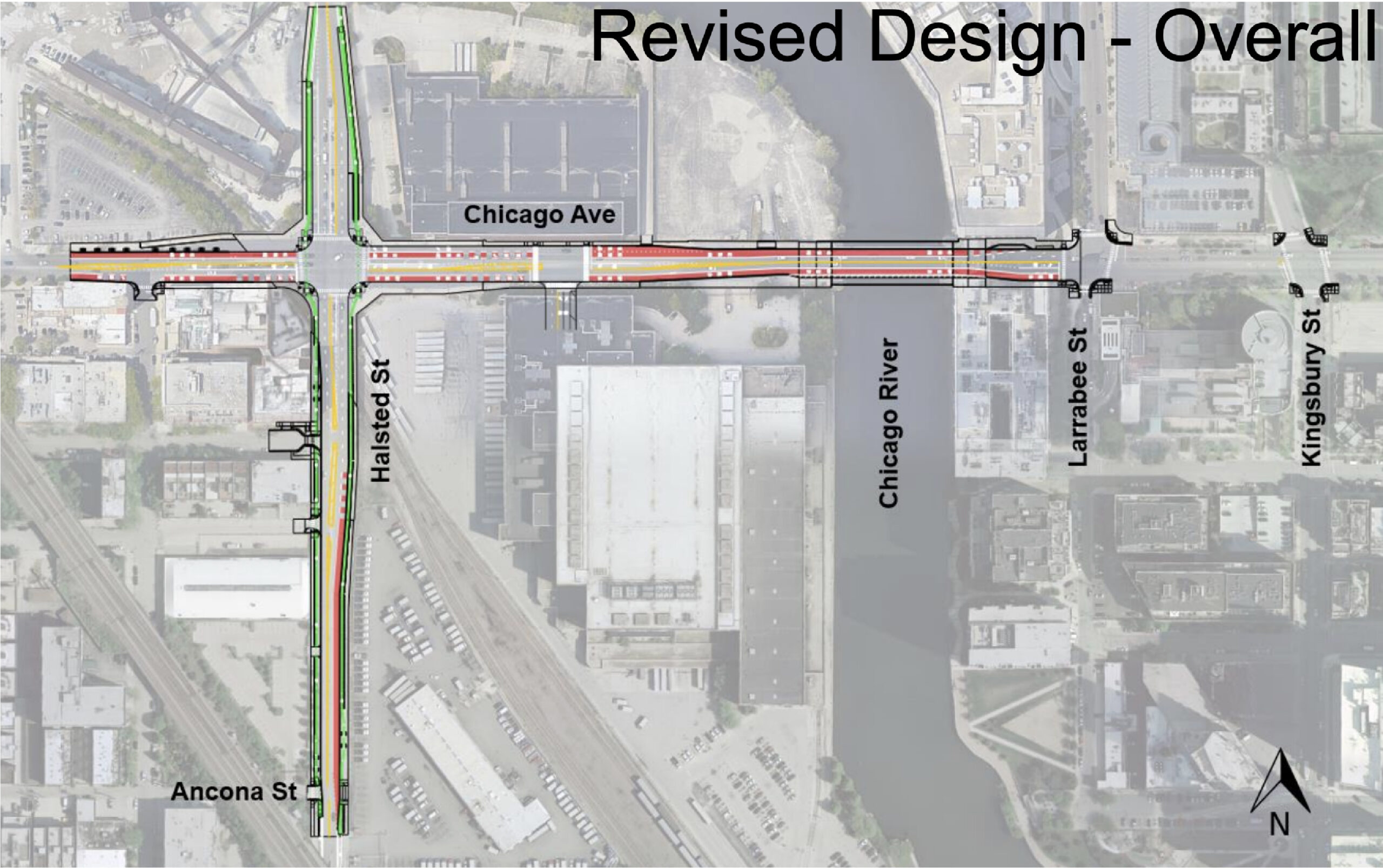
Site map of reconstructed intersection via CDOT
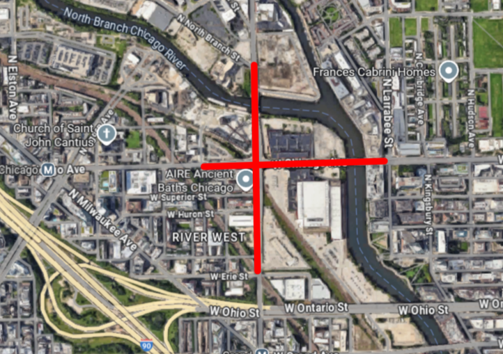
In red, Halsted Street closure and Chicago Avenue lane reduction zones, via Google Maps
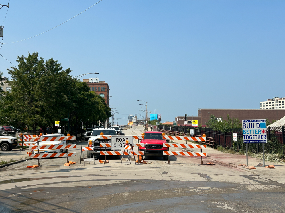
Southbound Halsted Street closures are marked on the north end at Division Street, but you can still go south down to North Branch Street. Northbound traffic from Grand Avenue can reach Erie Street and turn west or east (a dead end.) Barriers block attempts to turn north and south onto Halsted Street from Chicago Avenue. There are signs on Halsted marking sidewalk closures as well, though pedestrians and cyclists are still moving through for now.
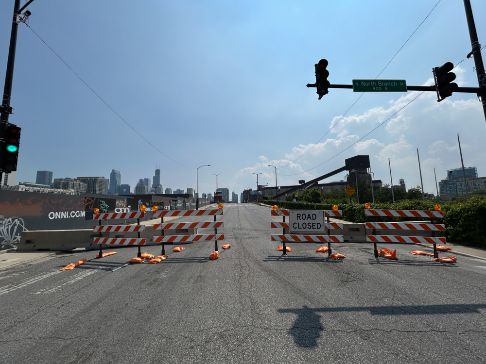
Halsted Street closure at North Branch Street just north of the river
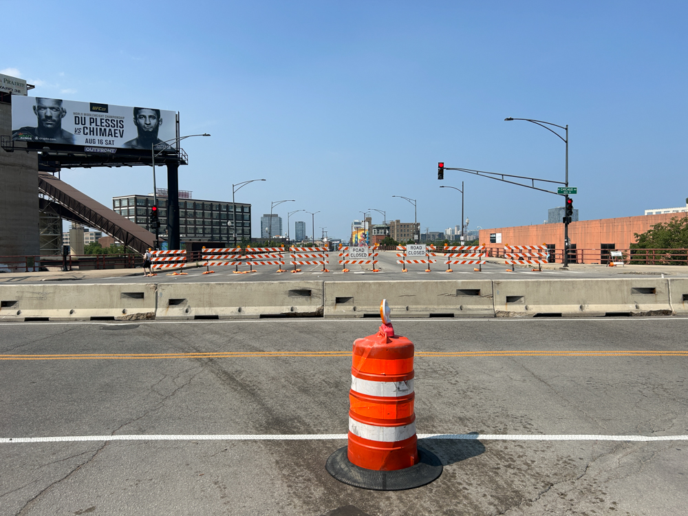
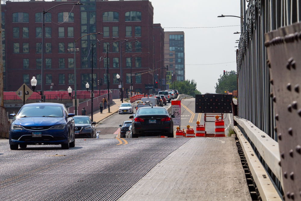
Halsted Street closure looking north from Chicago Avenue
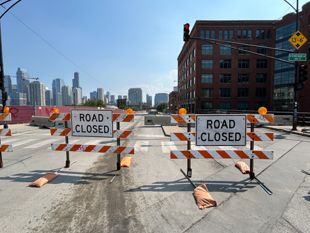
Halsted Street closure looking north from Erie Street
Halsted Street closure looking south from Chicago Avenue
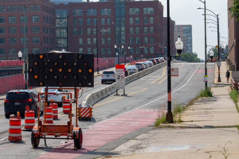
Chicago Avenue is reduced to a single lane in each direction between Larrabee Street to the east and Peoria Street to the west. To repeat, turns off Chicago onto Halsted are prohibited.
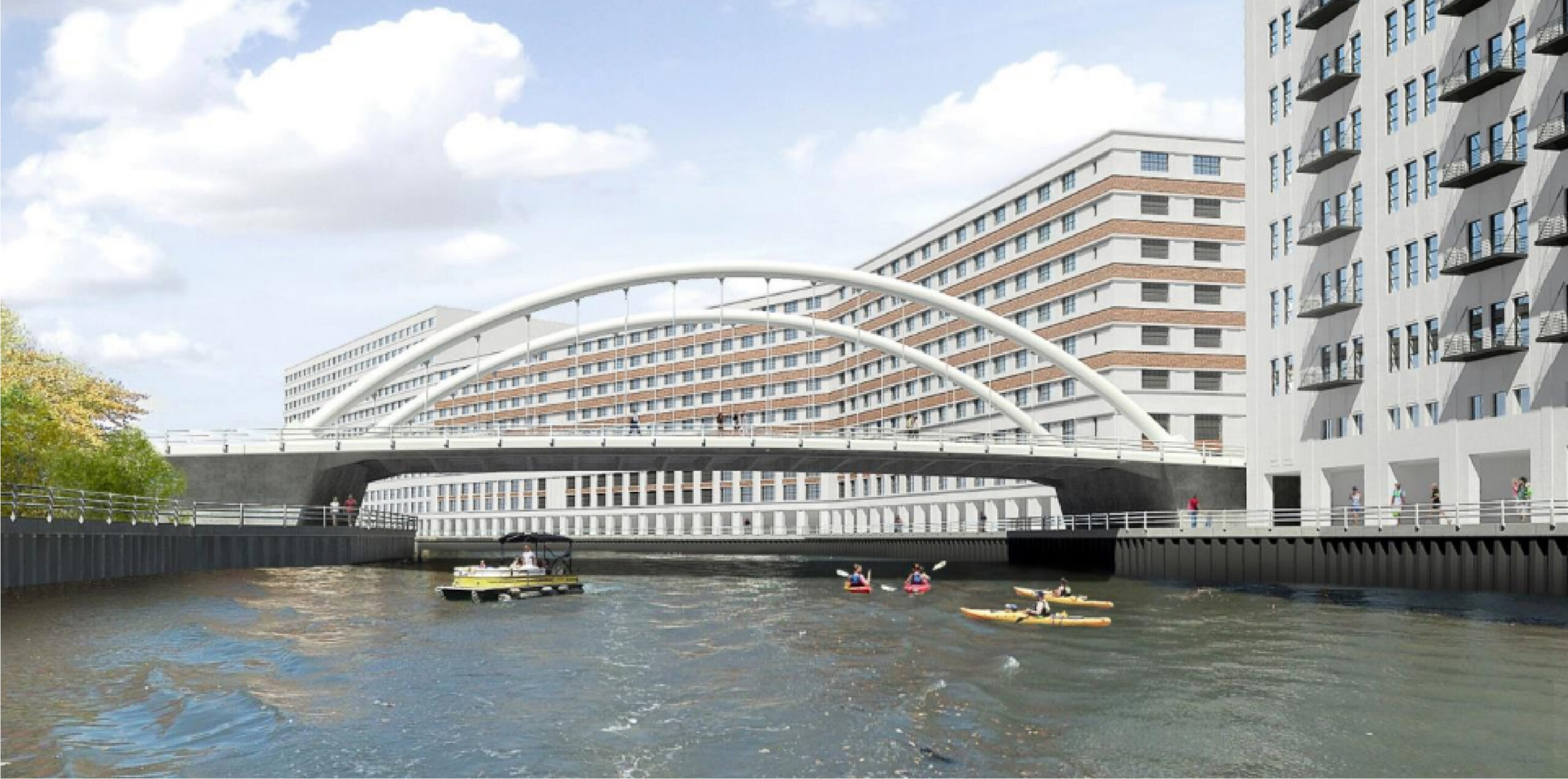
Rendering of the new Chicago Avenue via CDOT
Westbound traffic crosses the Chicago Avenue Bridge, then merges left onto the eastbound lanes
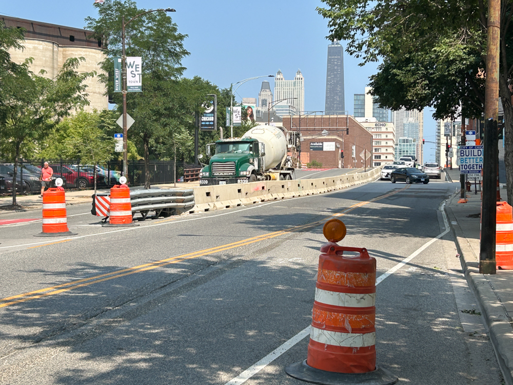
Lane closures on Chicago Avenue west of Halsted Street
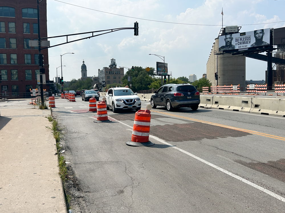
Traffic moves through the intersection of Halsted Street and Chicago Avenue
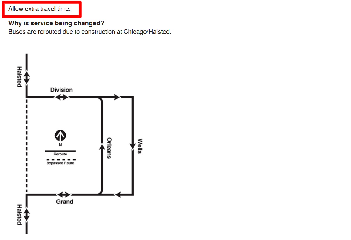
The reroute plan for the Route 8 Halsted bus, via the CTA. Allow extra time, indeed.
The CTA’s Route 8 bus is rerouted according to the graphic above. Route 66 buses are still traveling on Chicago Avenue, but are not making stops within the construction zone.
Subscribe to YIMBY’s daily e-mail
Follow YIMBYgram for real-time photo updates
Like YIMBY on Facebook
Follow YIMBY’s Twitter for the latest in YIMBYnews
Daniel,
First paragraph, you have closure will continued thru “December 26” but you mean to say “December 2026”. Let’s not give the poor readers false hope.
Also, the Chi Ave bridge will be shutdown around Oct 2025 until Dec 2026 or completion.
Thank you. Fixed the 26, and added clarity on the full October closure.
Will the new bridge eliminate the choke point where two lanes have to go down to one? Or will we just get a nice new choke point, in which case why all the bother with replacement?
Does anybody know?
In that rendering, I see two bus lanes and two car lanes on the bridge. Without allowing four lanes of general traffic to cross the bridge, I don’t see how the choke point would be eased.
Nope. The new mantra at CDOT is “Road Diet”.
The bridge will be built to full 5 lanes width, but stay with one lane each way and turn bay East bound. The addition is a bus lane each way and big sidewalks.
Do not worry, once you see what they are going to do to Division, you won’t be as angry with Chicago. LOL
I mean what is the alternative? Destroy every building and make the roads wider? They tried that in the 60’s with the overpasses on Ashland and Pershing and Belmont and Western and they results weren’t any better. it just made everything more ugly and expensive to maintain. Why does anyone believe traffic in River North will flow like it does in Peotone?
They in fact are making the bridge bigger, currently at three it will be full 5 lanes wide.
The issue people have is the Bus Lane that is only used 6 times an hour if the buses are not bunching. However, like the rest of Chi Ave heading east it is “Bus Only” certain times of the day and used as parking the rest.
Lastly, the fact that the Jane Byrne has been messing with the area for a decade, the Kennedy work for the last 3 years and now the post pandemic work life situation, we will see how traffic sorts itself out in 2027.
It looks like they are limited by the right of way of the road and also the buildings on either side of Chicago Ave on the East side of the river. I don’t really see how they can make it wider unless they want to demolish a bunch of buildings. Hopefully the Bus lanes will allow for higher passenger throughput on the bridge. I believe the reason they are replacing the bridge is because the viaduct is at the end of its life and the current bridge was a temporary replacement put in place because the old bridge degraded quicker than the viaduct and was falling down. Either they replace the Bridge and Viaduct or just demolish it all and have none at all.
Another example of inept lazy CDOT bridge engineers replacing in kind without looking at the site conditions. This is a clumsy off the shelf design that they are starting to repeat; expensive new infrastructure should be an improvement and make traffic flow better. Acting Commissioner Craig Turner needs to look at this foolishness.
Are any local news reporters pushing CDOT on this?
in what regard?
The bus lanes will help move people more efficiently. Bus riders are already half of the people traveling on Chicago on any given day, so ensuring they can move quickly and consistently is a big improvement.
Halsted 8 is now rerouted along Milwaukee/Elston/Division until December 2026. Any details you can share related to that change?
I have no details. Maybe the CTA thinks this will be a more efficient detour than Division/Grand.
As a taxpayer who lives just around the corner from this roadwork and new casino, I really hope the choke point is eliminated with the new bridge. There will be a lot of unhappy neighbors if this doesn’t take place!
As a taxpayer who takes the Chicago bus fairly often, I’m glad they are making the bus lanes equal with the private vehicle lanes.
I would rather have a choke point than a drag strip any day of the week. If you want nice wide streets, move to the nice wide burbs. No desire to see this turn into Golf Rd.
Agreed. Around 50% of the people going east/west on Chicago Ave are on the buses (including many with disabilities), and this is also one of the city’s busiest bus routes. Many are seniors and/or people with disabilities. Encouraging car traffic only leads to continual gridlock, especially in a densely populated city. It’s only going to be a “choke point” for people who choose to drive through it (obviously, service vehicles, contractors, etc have little choice, but they make up a minority of the vehicles on the streets). Free flowing traffic is only possible in areas with low population density, and for anyone who wants that…there are countless places in this country for it; more than there are high density, urban environments.