
As evident from our last installment of ‘Lost Legends’ showcasing the Prentice Women’s Hospital, once-celebrated designs may reveal impracticalities as functional demands evolve. While not “legendary” in a traditional sense, the story of the construction and later removal of DuSable Lake Shore Drive’s zig-zag ‘S’ curve conveys a similar notion of a city adapting to changing infrastructural needs.
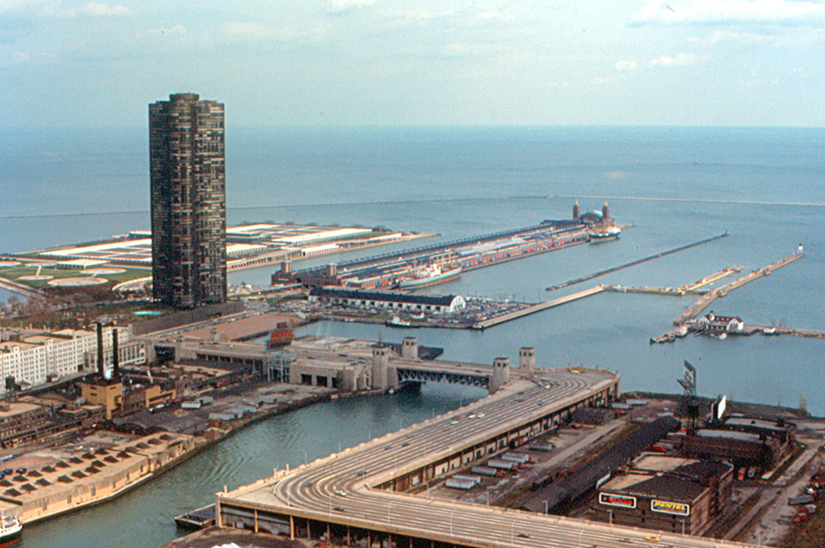
1980s aerial shot of Lake Shore Drive. Photo by Roger W via Flickr Creative Commons
Introduced in the 1930s, the ‘S’ curve was an inventive response to the era’s slower-paced traffic. It featured two sharp 90-degree turns, fitting for the slower vehicles of the time. However, as traffic speed increased, this once necessary design gradually became a source of congestion and safety concerns. Over time, the drawbacks of the stretch became increasingly apparent, as accidents and delays increased proportionally to faster speeds and greater traffic volume.
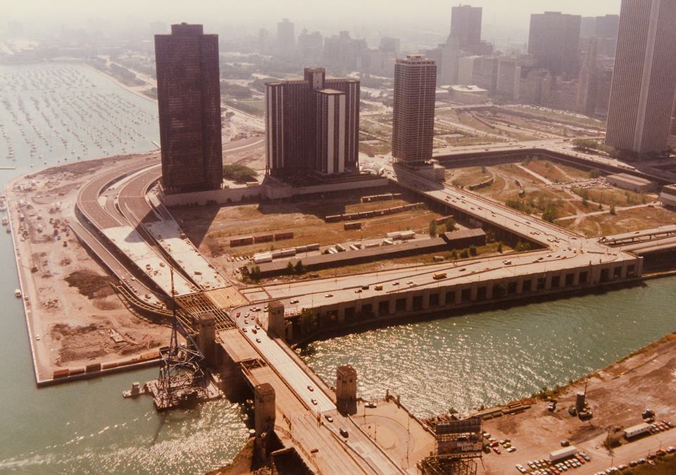
Rerouting of Lake Shore Drive. Photo via CARLI Digital Collection at UIC
In response to growing traffic and safety issues, the city embarked on a redesign of the ‘S’ curve in the 1980s. The sharp turns were transformed into a smoother curve by the engineering firm Benesch. The realignment began in 1982 and officially complete in 1986. Post reconstruction, the now-named DuSable Lake Shore Drive efficiently manages high volumes of traffic while ensuring safety. The redesign revitalized the previously underdeveloped Lakeshore East, now a densely populated neighborhood characterized by glassy skyscrapers and multiple public parks.
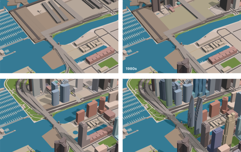
New Eastside area in the 1960s. Photo via YIMBY+
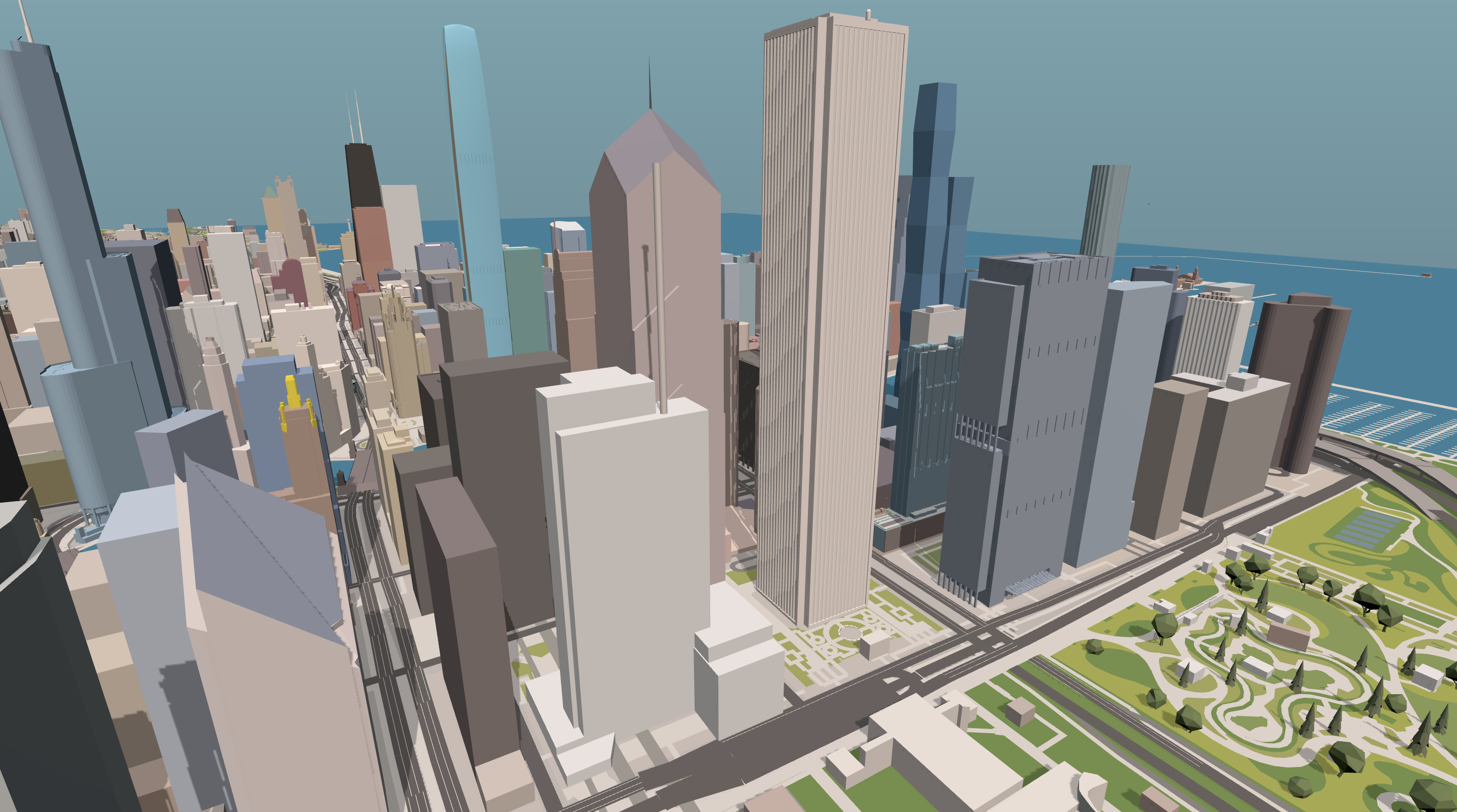
New Eastside area in the 2030s. Photo via YIMBY+
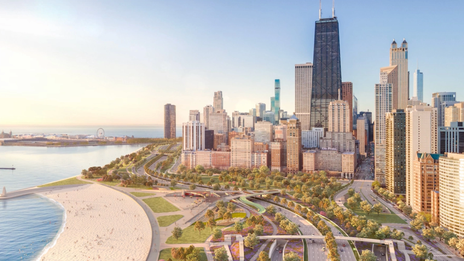
Updated Oak Street Beach lakefront. Rendering via Illinois Department of Transportation
Today, the story of Chicago’s built lakefront continues. To the north at Oak Street Beach, an ambitious plan has recently been updated, showcasing massive straightening of the thoroughfare along with an assortment of added outdoor amenities and new landscaping. These plans underscore a trend towards considering the lakefront not solely for vehicles, but rather in a holistic way that prioritizes human enjoyment of the lake.
Subscribe to YIMBY’s daily e-mail
![]()
Follow YIMBYgram for real-time photo updates
Like YIMBY on Facebook
Follow YIMBY’s Twitter for the latest in YIMBYnews
Noticed the Tribune East Tower in the 2030 pictures. Is this project still scheduled to start in Feb 2024?
They had a project update a while back embedded in another article. It should be, but the details were not major.
I remember as a kid in the 80s we took many trips on LSD (not THAT kind of trip) and my dad would always announce when we were approaching the S curve. Later we walked the fresh pavement of the new bypass just before it opened and remarked that it would be unlikely anyone would stroll peacefully through those lanes again.
In terms of Oak Street, I really hope the most ambitious plans for that space come to fruition. I’ve witnessed multiple scrapes and accidents involving the concrete walls as cars fail to slow down. But as importantly, Oak Street Beach is a gem but feels totally isolated from the Mag Mile by decrepit concrete tunnels under 8 lanes of highway. Those same lanes are also omnipresent – highly visible and audible – for those enjoying the beach and its cafe. Providing easier access, more amenities, and a buffer from traffic all feel like no-brainers to me given that the road needs reconstruction anyway.
“These plans underscore a trend towards considering the lakefront not solely for vehicles, but rather in a holistic way that prioritizes human enjoyment of the lake.” – the lakefront was never originally conceived of as an artery for motorized vehicle. These project to reconnect the city and its people to designated green space is not only past due, it’s also an investment and divergence from the motorized vehicle-addiction that have plagued US cities since the 60s.
Side opinion/point: Bike the drive should happen weekly to further connect our city with the shared resource that is DLSD.
S curve exactness where with today street names.