
YIMBY has new photos of the site where Lendlease plans to build out the remainder of the northern portion of the Riverline complex. The seven-acre plot of land is already occupied by a walkway, a small park, and The Cooper, addressed as 720 S Wells Street, one of the five residential buildings planned for the property.
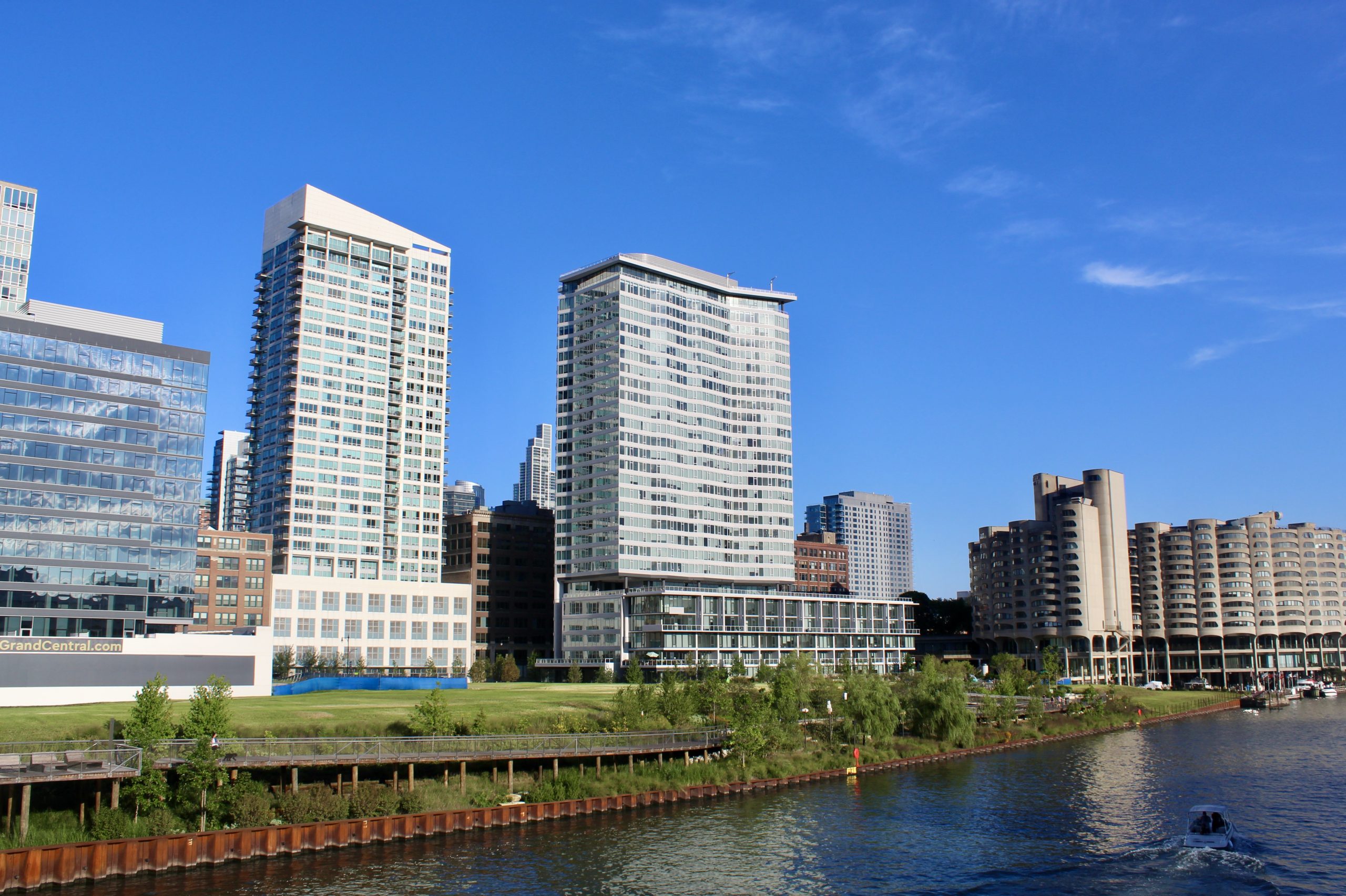
The northern Riverline plot, facing east. River City (built 1986) on the right. Photo by Jack Crawford
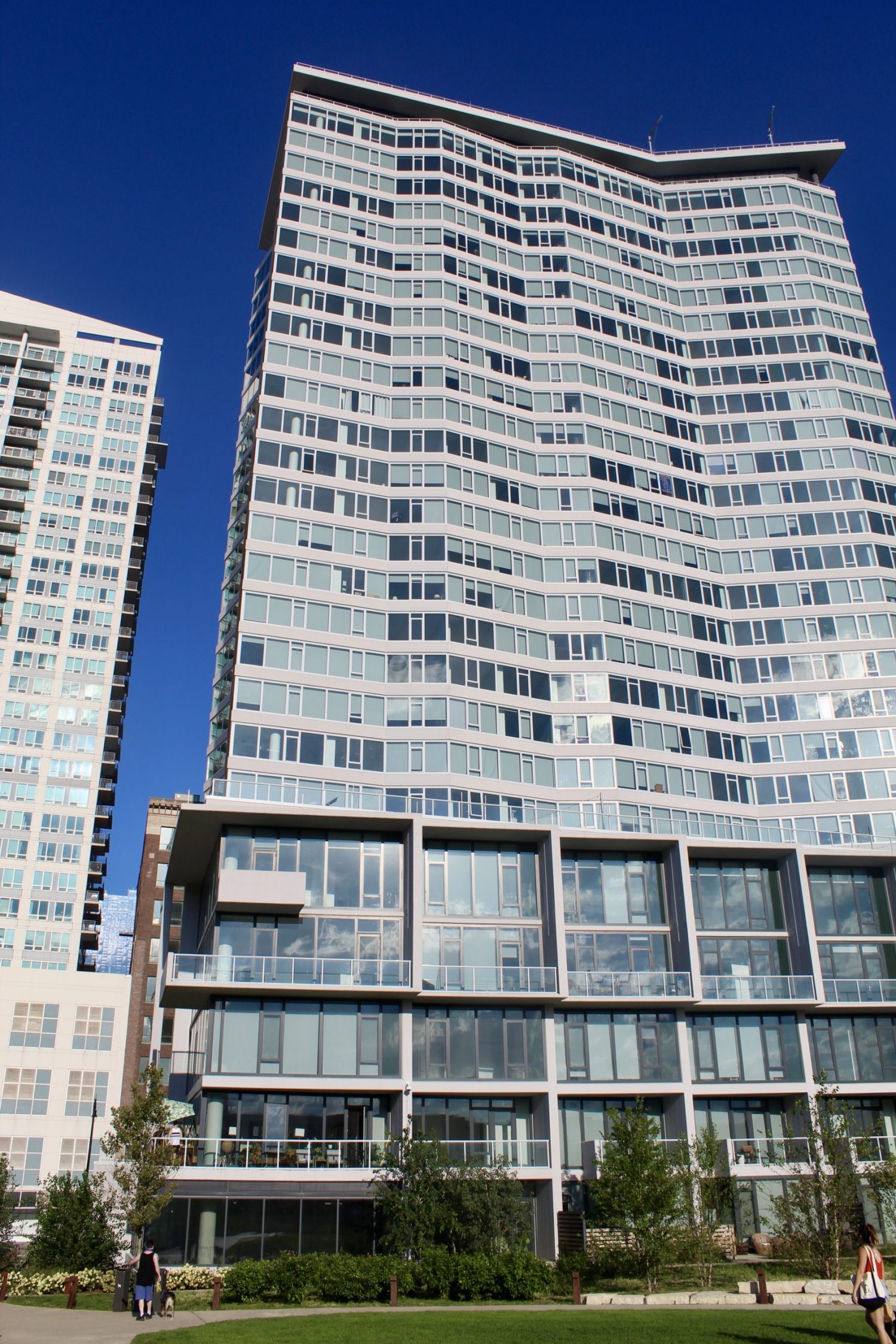
Small inner park and the first of five buildings for Lendlease’s share of the Riverline development. Photo by Jack Crawford
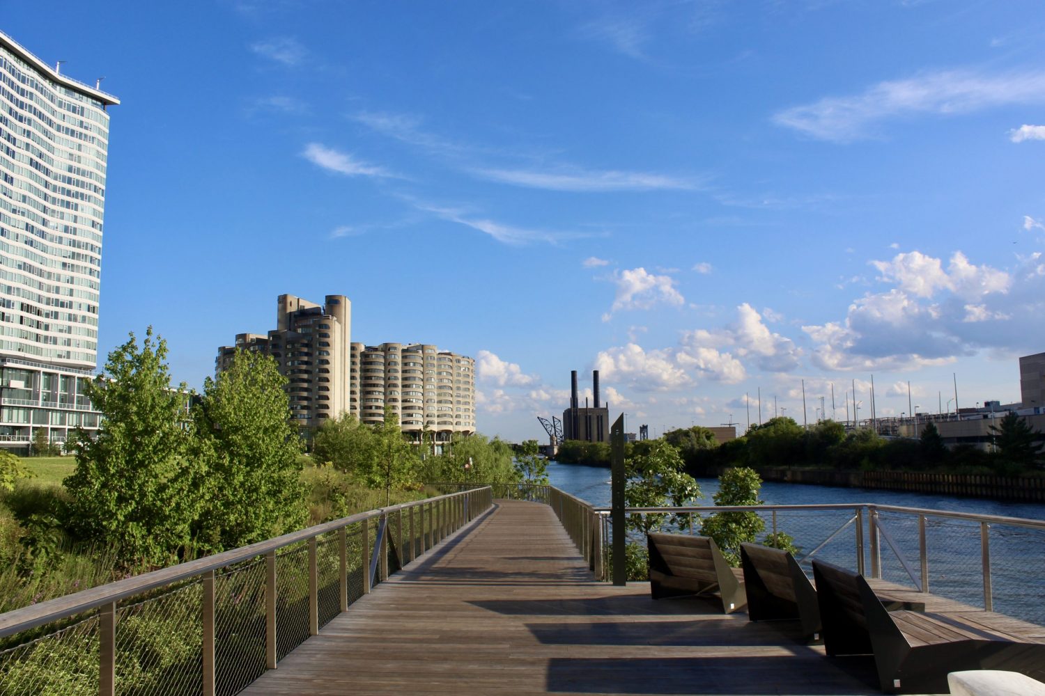
View from the walkway lining Lendlease’s Riverline portion, facing south. Photo by Jack Crawford
According to Curbed Chicago, the site is the northern section of two halves within the Riverline mega development, split around the 35-year-old River City development, that is currently under renovations. In 2018 Lendlease and CMK, the joint developers of the originally unified project, split under amicable terms so that Lendlease would develop the northern portion, coined “Southbank”, and CMK would develop the southern portion.
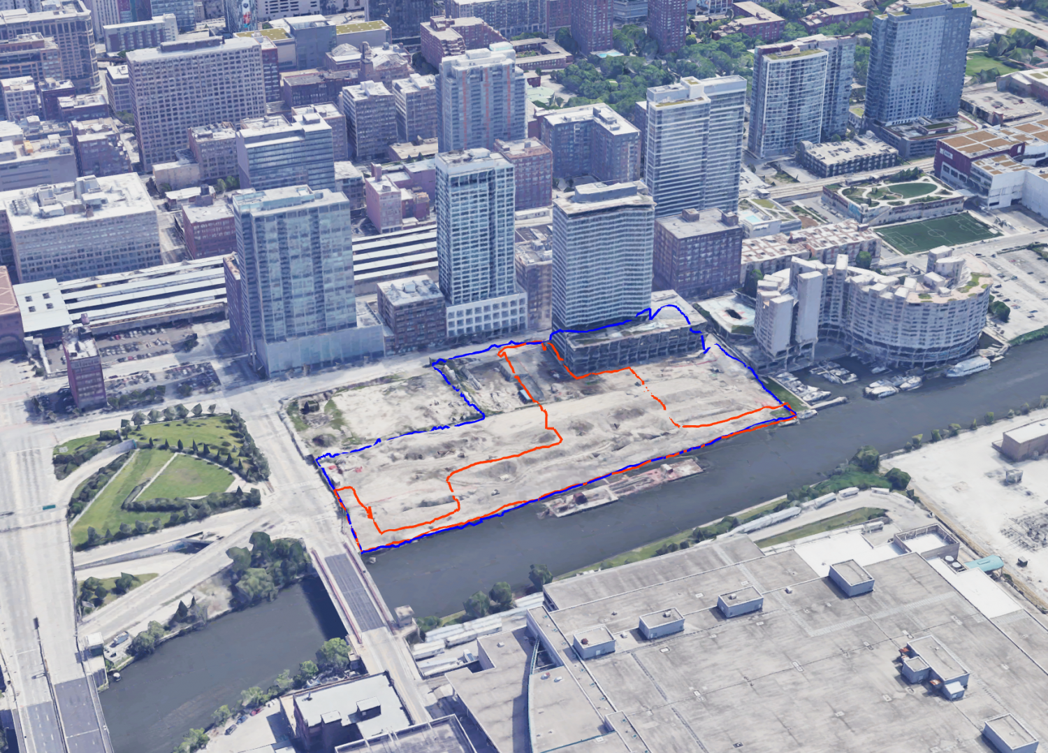
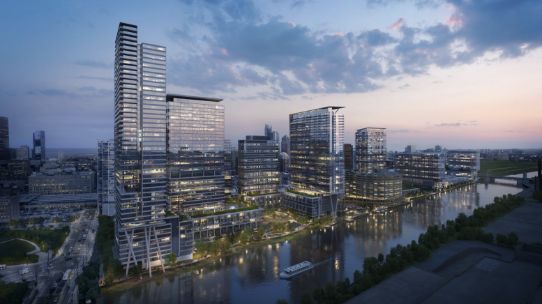
Aerial view of the Riverline site highlighted in blue, with its inner public space highlighted in orange. Visualization by Jack Crawford via Google Earth
Lendlease’s share of the project is located just south of the Loop, a nine-minute walking distance from The Willis, formerly known as the Sears Tower. Nearby transit include a three-minute walk northeast to bus route 36 stopping at Financial Place & Ida B Wells Drive, a five-minute walk northeast to the Blue Line CTA L stop at LaSalle Station, and a seven-minute walk northeast to the Red, Brown, and Purple Line CTA stops at LaSalle/Van Buren Station.
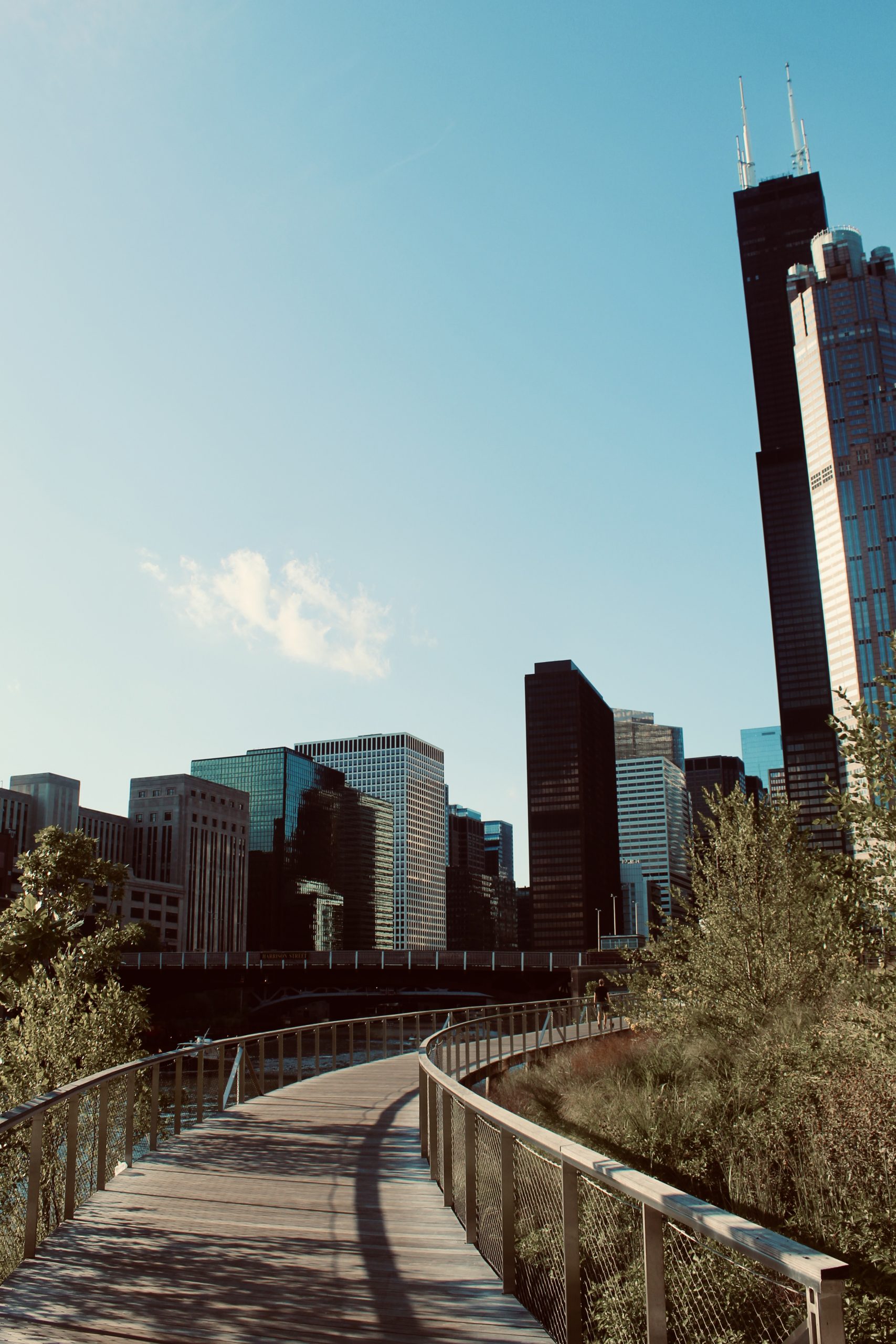
View of the Sears tower and surrounding Loop and West Loop from the Riverline walkway in Southbank Park, facing northwest. Photo by Jack Crawford
The programming of the remaining structures and whether they will include rental units, condominiums, or a mix, remains to be determined by market demand. Perkins+Will, who designed the entire Riverline project, carries a visual dialog throughout the buildings’ facades that is light in both color and form. The use of white and glass as the primary facade elements evokes a sense of openness, while the jagged, jutting angles of the exterior walls echo the sense of movement also seen in how the built meets the river. Such interaction includes walkways as a means to hover above the landscaped river banks, as well as a series of stepped-back rock formations that mingle with the hillside.
At this point, only the southeast-most building has been completed. Lendlease’s website lists 2026 as the opening date for the other four, although groundbreaking dates are not currently known.
Subscribe to YIMBY’s daily e-mail
![]()
Follow YIMBYgram for real-time photo updates
Like YIMBY on Facebook
Follow YIMBY’s Twitter for the latest in YIMBYnews
Be the first to comment on "New Photos Show the Partially Complete Northern Portion of Riverline in South Loop"