
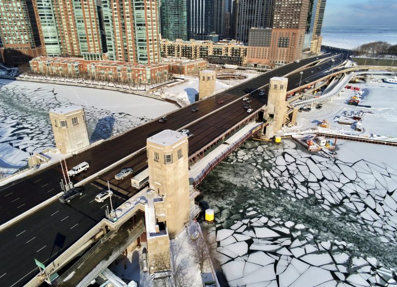
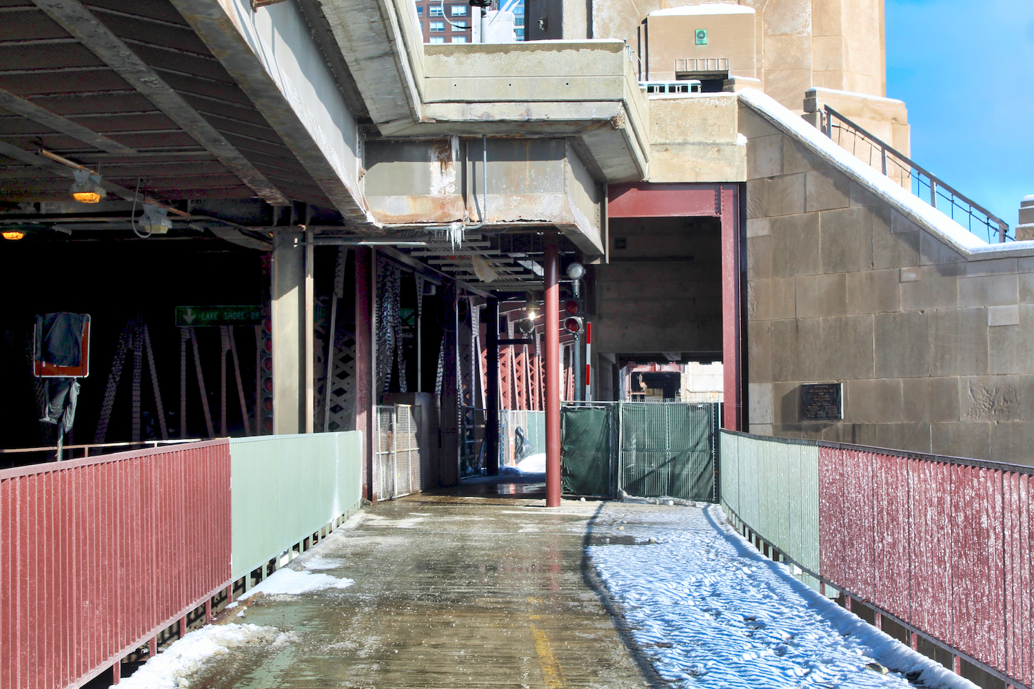
Current photos show the recent partial opening of the Navy Pier Flyover‘s bridge section, located at the mouth of the Chicago River.
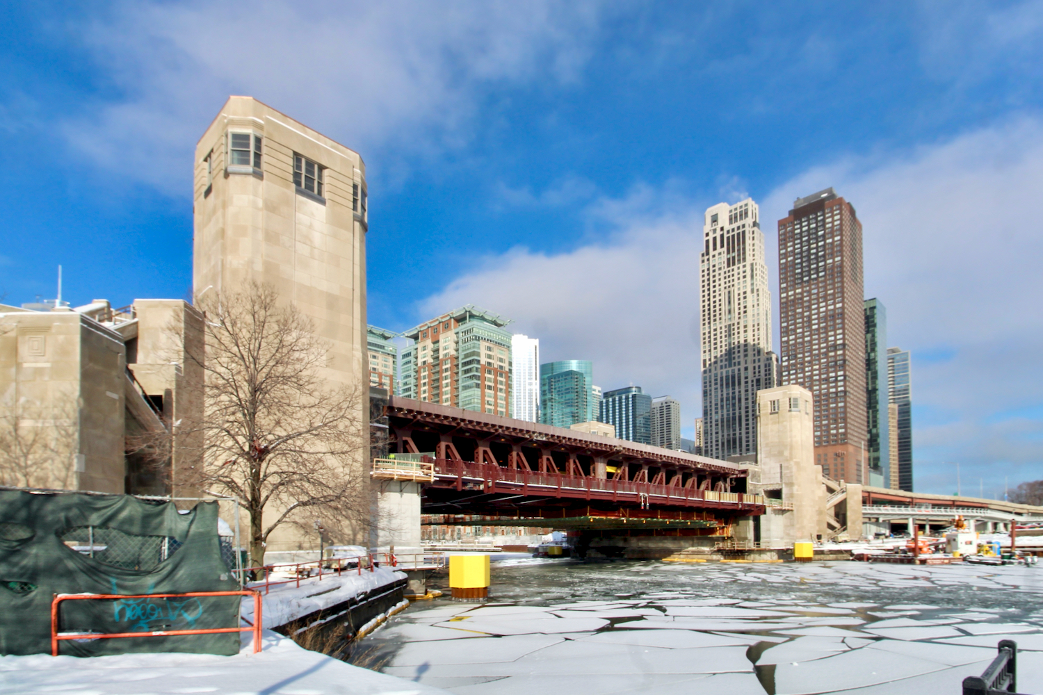
Navy Pier Flyover Phase 3. Photo by Jack Crawford
Navy Pier Flyover Phase 3. Photo by Jack Crawford
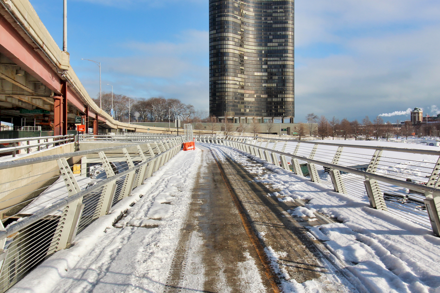
This opening represents a key milestone of the third and final phase of a 1,750-foot elevated path planned by the Department of Transportation to allow for wider and more streamlined bike and pedestrian access along the stretch of lakefront trail by Navy Pier.
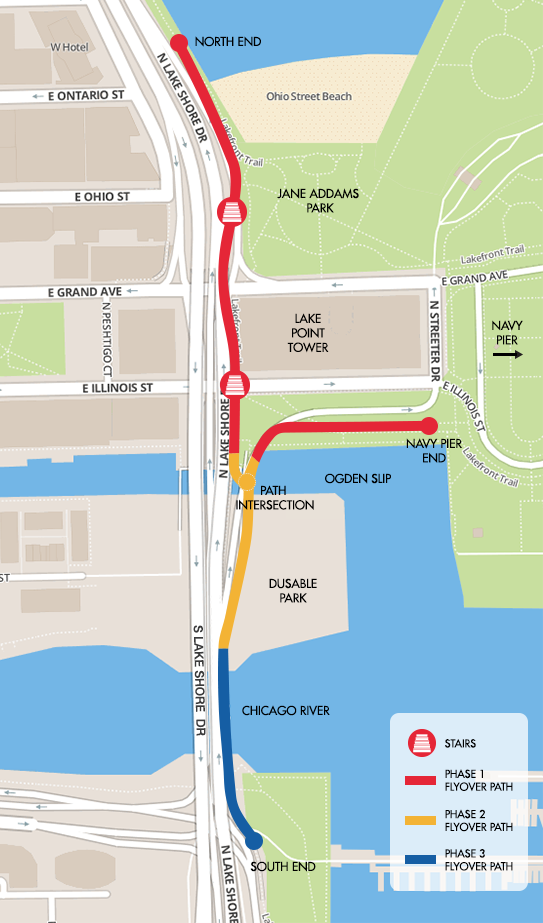
Navy Pier Flyover phases (Phase 3 in blue). Map via City of Chicago
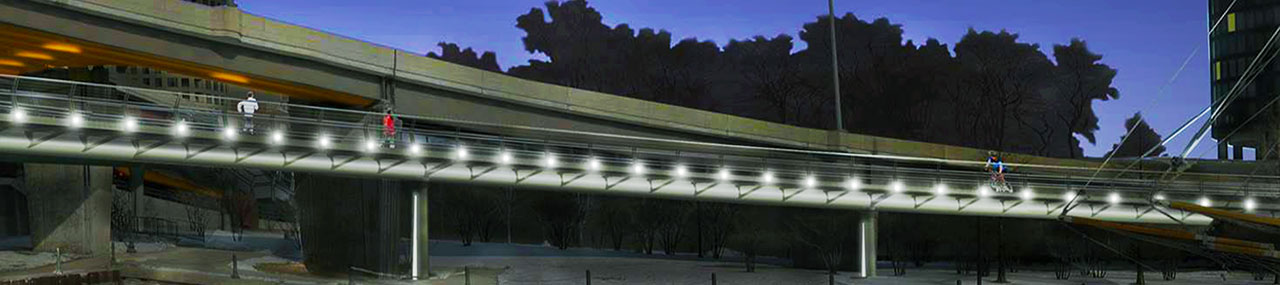
Navy Pier Flyover. Rendering by HNTB
The two completed phases cover the distance from just north of Ohio Street Beach to the southern tip of DuSable Park. The underway and southernmost third stage connects the pathway to the Lakeshore East side of the Chicago River.
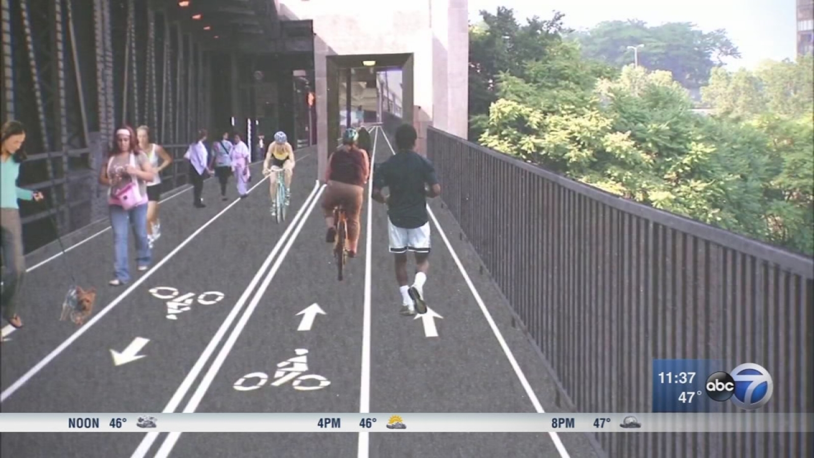
Navy Pier Flyover Phase 3. Rendering by HNTB via ABC
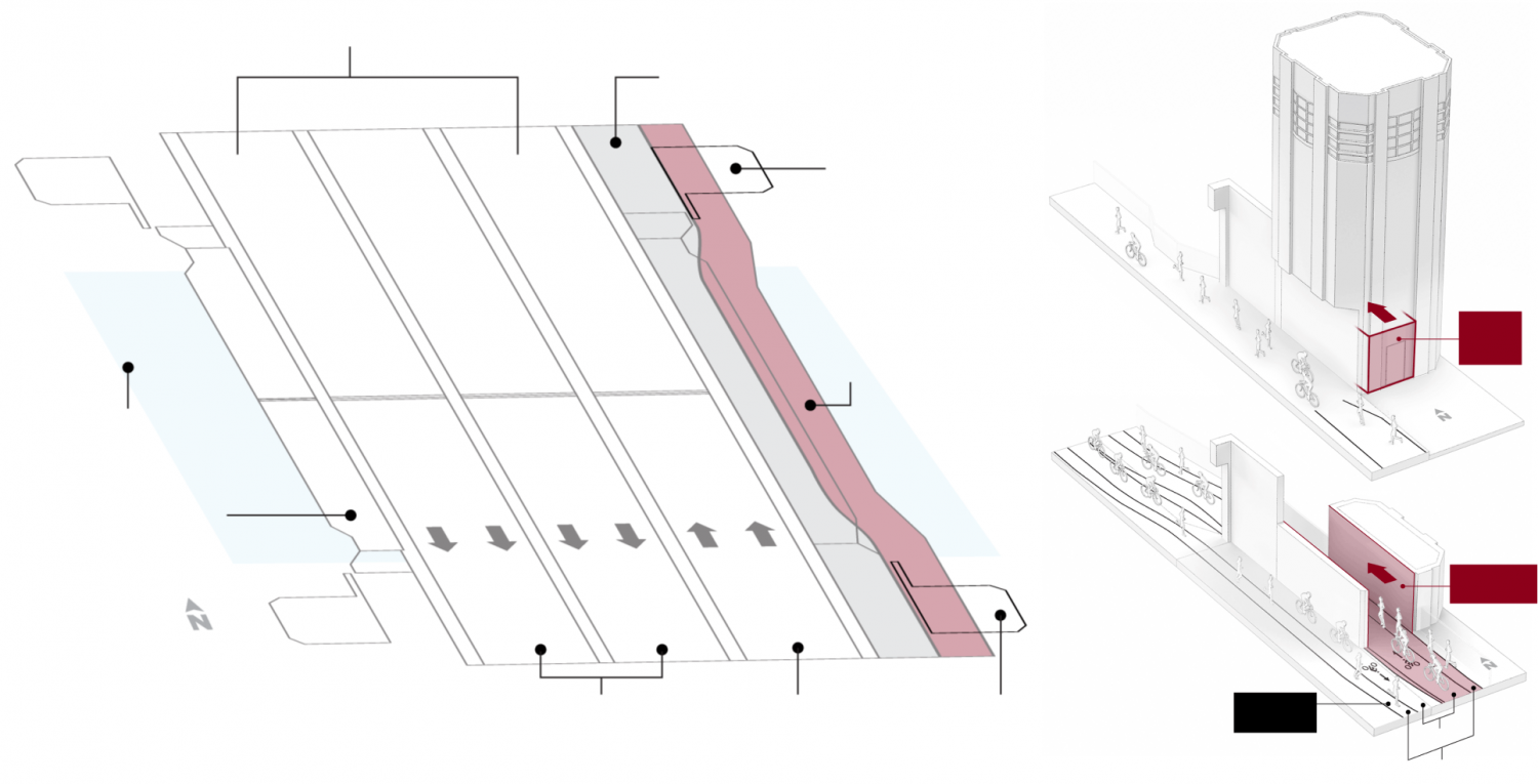
Diagrams of Navy Pier Flyover Phase 3 bridge portion (in red). Diagram by HNTB via Chicago Tribune
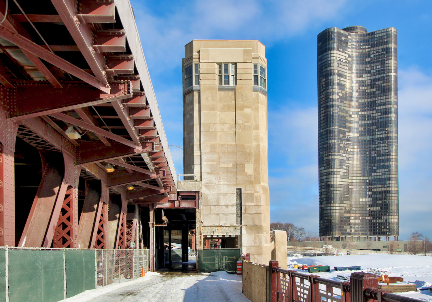
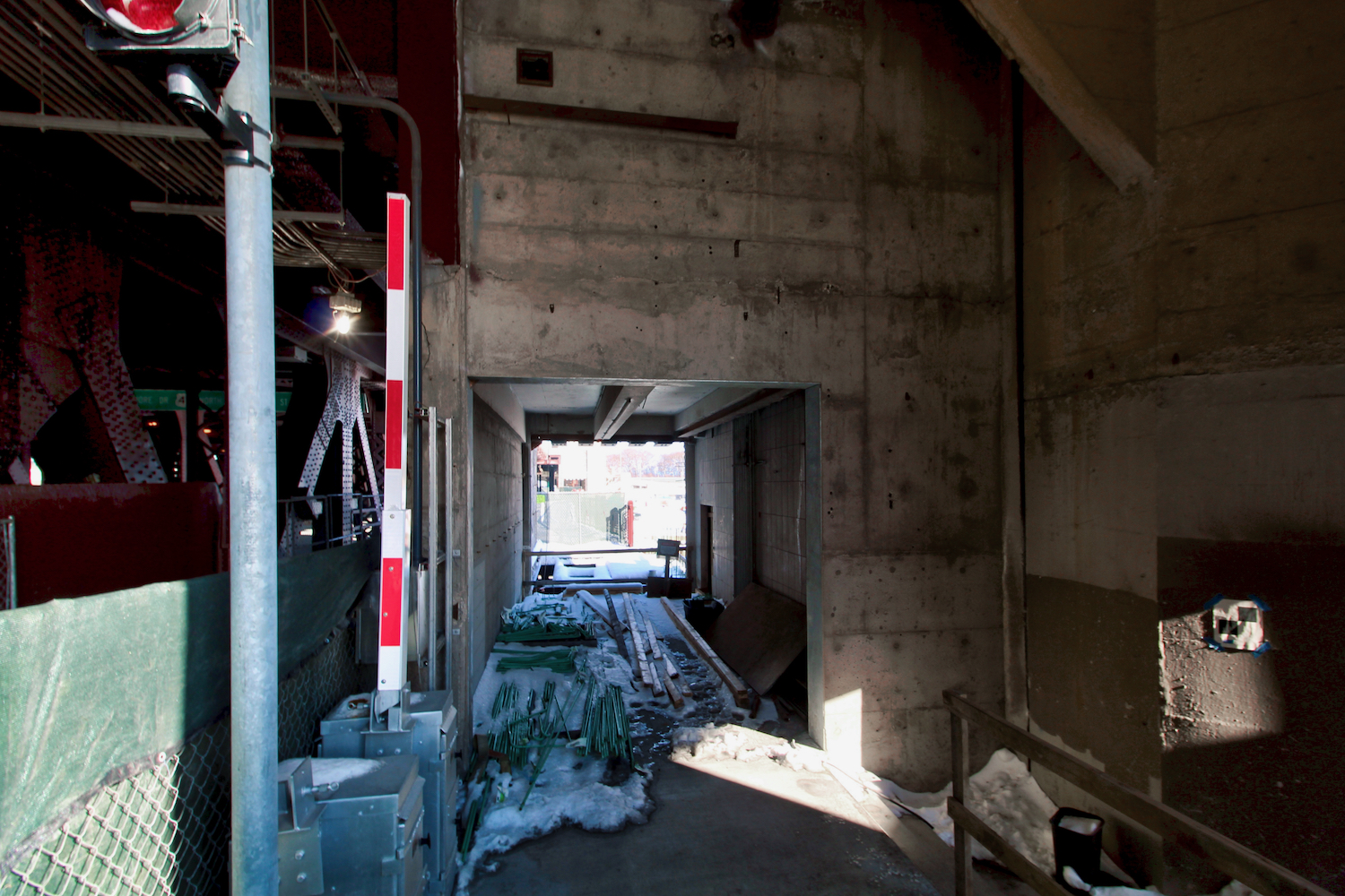
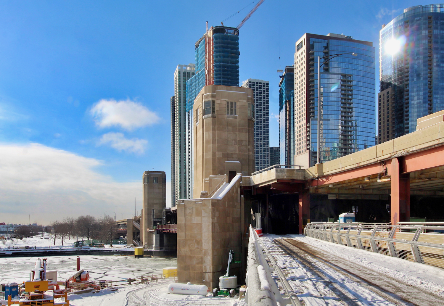
HNTB is the designer behind the elevated system, which for the first two phases used a steel tube and “rib” system to allow for greater degrees of freedom. For the third phase, the path camouflages into an extended walkway along the existing Outer Drive Bridge, maintaining a minimum 16-foot width by cantilevering over the river and tunneling through the bridge’s towers.

Navy Pier Flyover Phase 3. Photo by Jack Crawford
Navy Pier Flyover Phase 3. Photo by Jack Crawford
Multiple bus options can be found for riders and walkers on both sides of the river, including Routes 2, 29, 65, 66, 120, 121, and 124 on the Streeterville side and Routes 4, 6, 20, 60, 124, 134, 135, and 136 on the Lakeshore East side. As for the CTA L, the northern end of the flyover has access to the Red Line via Grand station, a 19-minute walk west. At the southern end, all CTA lines are located within a 20-minute walk southwest of the project toward The Loop.
Navy Pier Flyover Phase 3. Photo by Jack Crawford
Navy Pier itself is within a six-minute walk east from the path, and can be reached via an integrated offramp that was built as part of Phase 1.
Navy Pier Flyover Phase 2. Photo by Jack Crawford
Navy Pier Flyover Phase 3. Photo by Jack Crawford
FH Paschen served as the general contractor for Phase 1, while Kenny Construction of Granite Construction has served as general contractor for Phases 2 and 3. Though the full length of this third phase is now accessible, part of the lane near the bridge tower area remains walled off. A full completion and opening is expected for later this year.
Subscribe to YIMBY’s daily e-mail
![]()
Follow YIMBYgram for real-time photo updates
Like YIMBY on Facebook
Follow YIMBY’s Twitter for the latest in YIMBYnews
Be the first to comment on "Bridge Portion of Navy Pier Flyover Now Partially Open"